
Pricing Change
New pricing for orders of material from this site will come into place shortly. Charges for supply of digital images, digitisation on demand, prints and licensing will be altered.
Craig Ruenshin


Enclosure (Period Unassigned), Field Boundary(S) (Period Unassigned), Shieling Hut(S) (Post Medieval)
Site Name Craig Ruenshin
Classification Enclosure (Period Unassigned), Field Boundary(S) (Period Unassigned), Shieling Hut(S) (Post Medieval)
Canmore ID 27208
Site Number NO04SW 9
NGR NO 0383 4009
Datum OSGB36 - NGR
Permalink http://canmore.org.uk/site/27208


- Council Perth And Kinross
- Parish Little Dunkeld
- Former Region Tayside
- Former District Perth And Kinross
- Former County Perthshire
NO04SW 9 0383 4009.
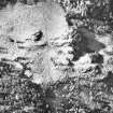
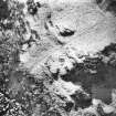
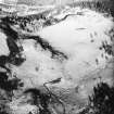
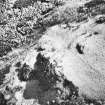
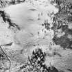
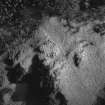
(NO 0383 4009) A rectangular formation with rounded corners, 46' long and 19' wide from centre to centre of the enclosing mound, is situated between the cup-marked rocks and Rohallion Castle (NO04SW 21 & 22) and slightly to the N.
The mound, of earth and stones, averages c. 5' wide and 2' high, and the level inside the enclosure corresponds withe the level of the ground to the N. There appears to be no local knowledge or tradition concerning it.
T M'Laren 1920
This appears to be the remains of an old stock enclosure associated with a few nearby shielings. Not an antiquity.
Visited by OS (RD) 22 February 1971.

