Accessibility

Font Size

100% 150% 200%

Background Colour

Default Contrast
Close Reset

Raws, Farm

Farmhouse (Period Unassigned), Farmstead (Period Unassigned)

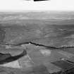
Site Name Raws, Farm

Classification Farmhouse (Period Unassigned), Farmstead (Period Unassigned)

Canmore ID 271892

Site Number NJ33NW 134

NGR NJ 33749 37264

Datum OSGB36 - NGR

Permalink http://canmore.org.uk/site/271892

Ordnance Survey licence number AC0000807262. All rights reserved.
Canmore Disclaimer. © Bluesky International Limited 2025. Public Sector Viewing Terms

Toggle Aerial | View on large map

Digital Images

Farmhouse, view from E
Farmhouse, view from EDistant oblique aerial view centred on the remains of Auchindoun Castle and field system, rig and shielings at Allt A'Choileachain, looking to the ESE.Farmhouse, view from NW

Administrative Areas

  • Council Moray
  • Parish Mortlach
  • Former Region Grampian
  • Former District Moray
  • Former County Banffshire

Archaeology Notes

NJ33NW 134.00 33749 37264

NJ33NW 134.01 33761 37218 Corn Mill

Raws Farm is described in the Object Name Book as' A large farm Steading the property of the Duke of Richmond'.

Name Book, 1872

Architecture Notes

NJ33NW 134.00 33749 37264

NJ33NW 134.01 33761 37218 Corn Mill

References

MyCanmore Image Contributions


Contribute an Image

MyCanmore Text Contributions