
Forth Defences, Middle, Braefoot Point Battery


Barracks (First World War), Graffiti (21st Century), Pillbox(S) (First World War), Storehouse(S) (First World War)
Site Name Forth Defences, Middle, Braefoot Point Battery
Classification Barracks (First World War), Graffiti (21st Century), Pillbox(S) (First World War), Storehouse(S) (First World War)
Alternative Name(s) Forth Defences; World War I
Canmore ID 271606
Site Number NT18SE 25.06
NGR NT 17799 83466
Datum OSGB36 - NGR
Permalink http://canmore.org.uk/site/271606


- Council Fife
- Parish Dalgety
- Former Region Fife
- Former District Dunfermline
- Former County Fife
A map of 1916 on War Office file (The National Archives WO 78/4396) shows a group of huts, just to the S of the building identified above as a barracks. A second group of about 10 huts, lies just north of the battery, at NT 17986 83562.
Information from HS/RCAHMS World War One Audit Project (GJB) 13 August 2013.
NT18SE 25.06 17799 83466
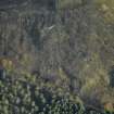
The accommodation block for the crew manning the battery is situated 90m downslope and W of the gun-emplacements (NT18SE 25.01).
Flat roofed and constructed almost entirely of stone it measures 63.8m by 9m N-S overall. Two defensive blockhouses have been built at the N and S ends. All the windows and doors have been blocked using breeze blocks relatively recently .
A separate building at NT 17808 83447 is situated 9m to the E of the S blockhouse.
Visited by RCAHMS (DE), March 2005
Project (March 2013 - September 2013)
A project to characterise the quantity and quality of the Scottish resource of known surviving remains of the First World War. Carried out in partnership between Historic Scotland and RCAHMS.
Field Visit (9 August 2022)
Barracks. NT 17800 83462. This barrack block provided accommodation for the garrison and a contemporary plan of it in The National Archives (WO 78/5169) provides sufficient information to negate the need for any modern survey. However, its walls are not built of stone as previously noted but of rectangular concrete blocks fronting an inner skin of brick. The current state of the building appears to be very good considering it is over 100 years old but access to it was not possible on the date of visit as the doorways and windows were blocked some years ago.
Perhaps a point worth noting is the building’s relationship to the ‘Inner Ring’ – a line of defence that comprised a series of pillboxes linked by a 10ft (3m high) palisade outside of which was a barbed wire entanglement. All the pillboxes had a line of sight along the front of a particular stretch of fence and, if necessary, could have fired upon any intruders attempting to break through. The boundary on the SE side of the battery is defended by three freestanding pillboxes but on the W side the pillboxes that were required were incorporated into the design of the barrack block. At the N end of the block there is a room (Room No.3 on the OS plan) with embrasures that were designed to cover the front of the fence to the NE, as far as the main gate to the battery. Other embrasures in the wall faced NW and W. At the S end of the building there was a room that was separated from the main block by a series of latrines and is noted as ‘Extra War Accommodation’ on both the 1912 and 1918 plans. It was accessed from outside by way of a doorway in its NE side. Otherwise, it was a mirror image of the room at the opposite end of the block, having embrasures in its SE wall that provided a line of sight along the front of the palisade as far the point some 98m distance where the fence changed angle. Embrasures in the other walls faced SW and W. What might have been a blind spot along the W side of the barracks was dealt with by the projection to the W of the Dining Room and the provision in its angled NW and SW corners of embrasures. The remains of fixings where the palisade adjoined the block are visible at both the NE and SE corners. What is not known is whether the palisade was carried over the flat roof of the barrack block.
Stores. NT 17808 83449. This rectangular building, which stands immediately E of the barracks, measures 8.55m from N to S by 2.25m transversely and contains three compartments all with a single doorway on the W. The external walls comprise rectangular concrete blocks with an inner skin of brick creating a thickness of 0.26m. The internal partition walls are of brick; the flat concrete roof sits 2.34m above the concrete floor. Lettering above the doorways indicate that the largest compartment (at the N end) was a coal store. The central compartment was for the storage of oil and paint was kept in the southernmost.
Meat and Bread Store. NT 17808 83440. Except for the flat area on which it once stood nothing is now visible of a building that was used to store bread and meat and was situated immediately S of the paint store. This building is not included on a 1912 War Department plan of the proposed battery but it is depicted on a 1918 OS plan which shows that it measured about 3.4m from N to S by 3.1m transversely.
Visited by HES Archaeological Survey (J. Sherriff, A. McCaig), 9 August 2022.
Ordnance Survey 1918. 1:360 scale plan of Special Survey War Department Site at Braefoot Point, Fifeshire - NLS: MapArea.C18:13(05).
War Office 1912 Plan, elevations and other details of the proposed gun battery at Braefoot Point. The National Archives, WO 78/5169.

