
Following the launch of trove.scot in February 2025 we are now planning the retiral of some of our webservices. Canmore will be switched off on 24th June 2025. Information about the closure can be found on the HES website: Retiral of HES web services | Historic Environment Scotland
Huntingtower


Enclosure (Period Unassigned)(Possible)
Site Name Huntingtower
Classification Enclosure (Period Unassigned)(Possible)
Canmore ID 26880
Site Number NO02SE 30
NGR NO 08019 24942
Datum OSGB36 - NGR
Permalink http://canmore.org.uk/site/26880


- Council Perth And Kinross
- Parish Tibbermore
- Former Region Tayside
- Former District Perth And Kinross
- Former County Perthshire
NO02SE 30 08019 24942
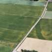
(NO 0804 2486) Cropmark forming rounded corner of possible rectangular enclosure.
(Undated) information in NMRS.

