Accessibility

Font Size

100% 150% 200%

Background Colour

Default Contrast
Close Reset

St Baldred's Cradle

Commemorative Monument (20th Century)

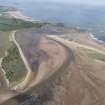
Site Name St Baldred's Cradle

Classification Commemorative Monument (20th Century)

Alternative Name(s) Viewing Seat

Canmore ID 268555

Site Number NT68SW 61

NGR NT 6380 8130

Datum OSGB36 - NGR

Permalink http://canmore.org.uk/site/268555

Ordnance Survey licence number AC0000807262. All rights reserved.
Canmore Disclaimer. © Bluesky International Limited 2025. Public Sector Viewing Terms

Toggle Aerial | View on large map

Digital Images

Oblique aerial view.
Oblique aerial view.General oblique aerial view of John Muir Country Park, Tyne Sands and St Baldreds Cradle, looking NE.General oblique aerial view of John Muir Country Park, Tyne Sands and St Baldreds Cradle, looking NE.General oblique aerial view of John Muir Country Park, Tyne Sands,St Baldreds Cradle, looking NE.General oblique aerial view of John Muir Country Park, Tyne Sands,St Baldreds Cradle, looking NE.

Administrative Areas

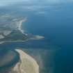
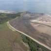
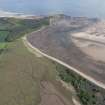
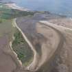
  • Council East Lothian
  • Parish Whitekirk And Tyninghame
  • Former Region Lothian
  • Former District East Lothian
  • Former County East Lothian

References

MyCanmore Image Contributions


Contribute an Image

MyCanmore Text Contributions