
Pricing Change
New pricing for orders of material from this site will come into place shortly. Charges for supply of digital images, digitisation on demand, prints and licensing will be altered.
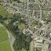
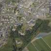
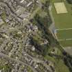
Turriff, Saint Congan's Church, Burial Ground And Gateway


Burial Ground (Medieval), Churchyard (Medieval), Gateway (17th Century)
Site Name Turriff, Saint Congan's Church, Burial Ground And Gateway
Classification Burial Ground (Medieval), Churchyard (Medieval), Gateway (17th Century)
Canmore ID 268453
Site Number NJ74NW 12.01
NGR NJ 72230 49820
Datum OSGB36 - NGR
Permalink http://canmore.org.uk/site/268453


- Council Aberdeenshire
- Parish Turriff
- Former Region Grampian
- Former District Banff And Buchan
- Former County Aberdeenshire
NJ74NW 12.01 72230 49820

