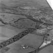
Accessibility

Font Size

100% 150% 200%

Background Colour

Default Contrast
Close Reset

Pricing Change

New pricing for orders of material from this site will come into place shortly. Charges for supply of digital images, digitisation on demand, prints and licensing will be altered. 


Wallacenick

Farmhouse (Period Unassigned), Farmstead (Period Unassigned)

Site Name Wallacenick

Classification Farmhouse (Period Unassigned), Farmstead (Period Unassigned)

Canmore ID 267686

Site Number NT73SW 398

NGR NT 72273 32751

Datum OSGB36 - NGR

Permalink http://canmore.org.uk/site/267686

Ordnance Survey licence number AC0000807262. All rights reserved.
Canmore Disclaimer. © Bluesky International Limited 2025. Public Sector Viewing Terms

Toggle Aerial | View on large map

Digital Images

Administrative Areas

  • Council Scottish Borders, The
  • Parish Kelso
  • Former Region Borders
  • Former District Roxburgh
  • Former County Roxburghshire

References

MyCanmore Image Contributions


Contribute an Image

MyCanmore Text Contributions