
Ruthvenfield House, Huntingtower


Cropmark(S) (Period Unknown)
Site Name Ruthvenfield House, Huntingtower
Classification Cropmark(S) (Period Unknown)
Alternative Name(s) Ruthvenfield House, Huntingtower 1
Canmore ID 26738
Site Number NO02NE 29
NGR NO 08471 25646
Datum OSGB36 - NGR
Permalink http://canmore.org.uk/site/26738


- Council Perth And Kinross
- Parish Tibbermore
- Former Region Tayside
- Former District Perth And Kinross
- Former County Perthshire
NO02NE 29 08471 25646
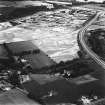
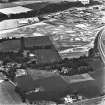
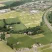
(NO 0846 2566) Crop-marks.
A short length of parallel ditches forming almost a right-angle situated just to the north of the dismantled railway, is visible on APs.
(Undated) information from (lost) OS Record Card.

