
North Sutor, Coast Battery


Pillbox (Second World War)
Site Name North Sutor, Coast Battery
Classification Pillbox (Second World War)
Alternative Name(s) Cromarty Defences; Fort North Sutor, Site No. 1
Canmore ID 267348
Site Number NH86NW 9.14
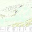
NGR NH 81964 69000
Datum OSGB36 - NGR
Permalink http://canmore.org.uk/site/267348


- Council Highland
- Parish Nigg (Ross And Cromarty)
- Former Region Highland
- Former District Ross And Cromarty
- Former County Ross And Cromarty
NH86NW 9.14 81964 69003
A type 25 (circular) pillbox which was formerly situated at the gate/entrance to the battery complex has now been removed and lies next to the building at NH 81984 68986.
The pillbox in the original position is visible on a RAF vertical air photograph (106G/UK751, 6039, flown 31 August 1945.)
Vsited by RCAHMS, (DE, SW), August 2000
Note (29 July 2013)
A pillbox lying face down was removed from its original location next to the entrance gate and been dumped between the RA storehouse and the No.2 Gun house. The pillbox is open at the rear and has only three facets to the front. Wrongly identified as a type 25 pillbox this is identical to the other pillbox recorded at the battery (see NH86NW 9.10). With its unusual construction and thin walls it may be that this is a First World War blockhouse (pillbox).
Information from RCAHMS (AKK) 29 July 2013.
Project (March 2013 - September 2013)
A project to characterise the quantity and quality of the Scottish resource of known surviving remains of the First World War. Carried out in partnership between Historic Scotland and RCAHMS.
Field Visit (13 March 2019)
This pill box, which is now situated upside down 5m S of the Gun Store (NH86NW 9.12), formed part of the defences of the battery introduced by the Army during World War 2. It is a half-hexagon on plan and measures up to 2.7m broad within reinforced cast concrete walls 0.27m thick that originally stood about 1.5m high with another 0.37m extending below the ground surface. The flat roof is damaged at the back, but each of the walls is distinguished by a rectangular gun port measuring 0.32m in breadth by 0.17m in height externally increasing to 0.5m by 0.25m internally. It is evident from part of a metal railing incorporated close to what must have been the W side of the structure that it was once integrated with the World War 2 security fence (NH86NW 9.51). An aerial photograph (106G/UK 751/6040) flown on 31 August 1945 shows that it was originally located on the W side of the N gateway opposite the guardhouse (NH81964 68998).
Visited by HES, Survey and Recording (ATW, AKK), 13 March 2019.

