Scheduled Maintenance
Please be advised that this website will undergo scheduled maintenance on the following dates: •
Tuesday 3rd December 11:00-15:00
During these times, some services may be temporarily unavailable. We apologise for any inconvenience this may cause.
Inninmore Bay
Fish Trap (Period Unassigned)
Site Name Inninmore Bay
Classification Fish Trap (Period Unassigned)
Alternative Name(s) Inninmore; Sound Of Mull
Canmore ID 267129
Site Number NM74SW 11
NGR NM 726 416
NGR Description NM c. 726 416
Datum OSGB36 - NGR
Permalink http://canmore.org.uk/site/267129
- Council Highland
- Parish Morvern
- Former Region Highland
- Former District Lochaber
- Former County Argyll
NM74SW 11 c. 726 416
The following sites were surveyed in 2002 (boathouses) and 2003 (fish traps) as part of a wider project to study the maritime landscape of the Sound of Mull.
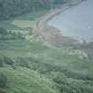
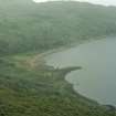
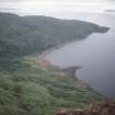
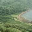
NM 726 416 Stone fish trap built at the western end of a gravel bay, the rest of which is clear, with no major river mouth or cleared landing area. At the centre of the bay stands a cottage built in 1862 and last permanently occupied in 1939. Behind it are the ruins of earlier cottages, occupied by 1770.
The trap is constructed of two straight sides with a small curved area where they meet. There is no obvious gap. Set close inside the inner face are several upright wooden posts, the tallest 90cm high: nine were located, some just stumps. They are whole small branches, complete with bark, and their appearance suggests use in the relatively recent past. The upper ends of the trap are buried under sand and gravel, and the difference in height between the inside and the outside is very noticeable.
Report lodged with Highland SMR.
Sponsor: Society of Antiquaries of Scotland.
P Martin and C Martin 2003.
Ground Survey (2002 - 2003)
The following sites were surveyed in 2002 (boathouses) and 2003 (fish traps) as part of a wider project to study the maritime landscape of the Sound of Mull.
NM 726 416 Stone fish trap built at the western end of a gravel bay, the rest of which is clear, with no major river mouth or cleared landing area. At the centre of the bay stands a cottage built in 1862 and last permanently occupied in 1939. Behind it are the ruins of earlier cottages, occupied by 1770.
The trap is constructed of two straight sides with a small curved area where they meet. There is no obvious gap. Set close inside the inner face are several upright wooden posts, the tallest 90cm high: nine were located, some just stumps. They are whole small branches, complete with bark, and their appearance suggests use in the relatively recent past. The upper ends of the trap are buried under sand and gravel, and the difference in height between the inside and the outside is very noticeable.
Report lodged with Highland SMR.
Sponsor: Society of Antiquaries of Scotland.
P Martin and C Martin 2003.


