
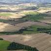
Forteviot


Barrow(S) (Prehistoric)
Site Name Forteviot
Classification Barrow(S) (Prehistoric)
Canmore ID 26567
Site Number NO01NE 35
NGR NO 05460 16820
Datum OSGB36 - NGR
Permalink http://canmore.org.uk/site/26567


- Council Perth And Kinross
- Parish Forteviot
- Former Region Tayside
- Former District Perth And Kinross
- Former County Perthshire
NO01NE35 NO 05440 16770
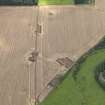
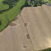
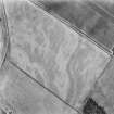
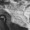
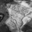
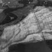
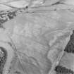
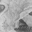
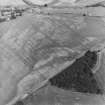
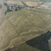
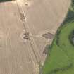
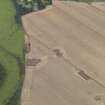
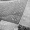
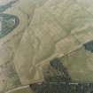
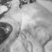
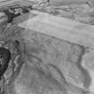
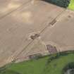
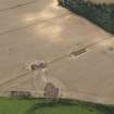
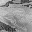
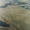
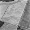
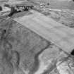
Three nearly square enclosures, the largest being c.10m across and the other two being considerably smaller and having a side in common. At the centre of each of the pair is an elongated mark about 2m long. These appear to be funerary enclosures with inhumation burials.
J K St Joseph 1976; 1978.
Whimster 1981, ii, 344, No. 51, 415, No. 17 probably refers to this site. He cites CUCAP [vertical] frame K17-AJ 104.
R Whimster 1981.
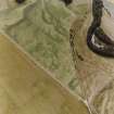
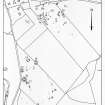
Aerial Photographic Transcription (16 May 1991 - 11 June 1991)
An aerial transcription was produced from oblique aerial photographs. Information from Historic Environment Scotland (BM) 31 March 2017.

