Following the launch of trove.scot in February 2025 we are now planning the retiral of some of our webservices. Canmore will be switched off on 24th June 2025. Information about the closure can be found on the HES website: Retiral of HES web services | Historic Environment Scotland
Cairnhead, Mulberry Harbour Project Construction Yard
Building(S) (20th Century), Concrete Platform (20th Century), Concrete Structure (20th Century), Hut(S) (20th Century), Pontoon (20th Century)
Site Name Cairnhead, Mulberry Harbour Project Construction Yard
Classification Building(S) (20th Century), Concrete Platform (20th Century), Concrete Structure (20th Century), Hut(S) (20th Century), Pontoon (20th Century)
Alternative Name(s) Rigg Bay; Cairnhead Mote; Cairn Head
Canmore ID 265635
Site Number NX43NE 87
NGR NX 48537 38381
NGR Description Centred NX 48537 38381
Datum OSGB36 - NGR
Permalink http://canmore.org.uk/site/265635
- Council Dumfries And Galloway
- Parish Whithorn
- Former Region Dumfries And Galloway
- Former District Wigtown
- Former County Wigtownshire
NX43NE 87 centred 48537 38381
See also:
NX43NE 8050 NX c. 4833 3840 Cairnhead Bay, Rigg Bay - Mulberry Harbour remains
NX44NE 8035 Centred NX 49540 47501 Port Whapple, Eggerness - Mulberry Harbour remains
NX44NE 8036 NX 48807 46478 and NX 48833 46443 Garlieston Bay - Mulberry harbour Remains
NX44SE 8007 NX 48528 44533 Rigg Bay - Mulberry Harbour Remains
NX44SE 8023 NX 47565 44644 Rigg Bay - Mulberry Harbour Remains
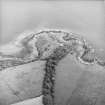
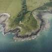
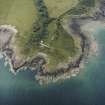
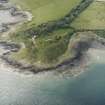
Construction yard and accommodation camp is situated on Cairn Head about 100m NW of the prehistoric fort NX43NE 4.
The remains incoporporate a large concrete platform, the concrete base for a strcuture, one flat roofed concrete building measuring about 14.8m by 6.2m overall and at least eight concrete hut bases. The yard occupied about 1.36 hectares of land.
The small yard was built to allow the construction and testing of sections, pontoons and bridging sections for the Mulberry Harbour Project to aid the D-day landings in Normandy 1944.
The camp and yard opened in March 1943 and about 120 men were accommodated in the camp which incoprated huts for Officers' and Sergeants mess with other ancilliary buildings.
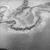
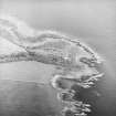
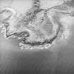
The yard is visible on vertical air photographs (106G/Scot/UK 43, 3022-3024, 4 May 1946), which show that by this date most of the buildings had been cleared from the site.
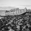
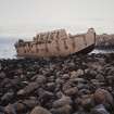
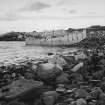
The concrete 'beetle' (NX43NE 8050), a reinforced concrete or steel, pontoon to carry a floating roadway is in Rigg Bay at c.NX 4833 3840. The pontoon has broken free of its moorings and now rests on the shore on the S part of Rigg Bay.
Information from RCAHMS (DE), April 2006
Field Visit (21 October 2015)
ShoreUPDATE 21/10/2015 This is a construction yard and accommodation camp for the Mulberry Harbour Project, part of the D-day preparations.
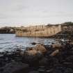
The complex includes brick and concrete structures in the hinterland, concrete hut bases and large concrete yards. Immediately behind the coast edge is a stone and brick shed. On the coast edge is the platform described in the original survey, constructed of stone and mortar walls standing up to 0.5m high, constructed directly onto bedrock, 1.9m square in plan, capped with a concrete slab roof. Just offshore is a single concrete beetle, a pontoon intended to form part of a floating harbour.
Visited by Scotland's Coastal Heritage at Risk (SCHARP) 2015


