Henge (Neolithic) - (Bronze Age)(Possible)
Site Name Forteviot
Classification Henge (Neolithic) - (Bronze Age)(Possible)
Canmore ID 26563
Site Number NO01NE 31
NGR NO 05288 17072
Datum OSGB36 - NGR
Permalink http://canmore.org.uk/site/26563
Ordnance Survey licence number AC0000807262. All rights reserved.
Canmore Disclaimer.
© Bluesky International Limited 2025. Public Sector Viewing Terms
- Correction
- Favourite


DP 083529
General oblique aerial view of the henge under excavation in 2009, taken from the E.
RCAHMS Aerial Photography Digital
27/8/2009
© Crown Copyright: HES

DP 083533
General oblique aerial view of the henge and square barrow under excavation in 2009, taken from the NE.
RCAHMS Aerial Photography Digital
27/8/2009
© Crown Copyright: HES

DP 094054
General oblique aerial view of the 2010 excavations at Forteviot, taken from the NNW.
RCAHMS Aerial Photography Digital
25/8/2010
© Crown Copyright: HES

DP 094058
General oblique aerial view of the 2010 excavations at Forteviot with the village beyond, taken from the SSE.
RCAHMS Aerial Photography Digital
25/8/2010
© Crown Copyright: HES

SC 1705538
Forteviot, oblique aerial view, taken from the SE, showing the cropmarks of henges, ring-ditches and an enclosure, and parts of a large pit-defined enclosure.
RCAHMS Aerial Photography
13/7/1995
© Crown Copyright: HES

SC 1705559
Oblique aerial view centred on the cropmarks of enclosures, henges, ring-ditches, a pit-enclosure and barrows, taken from the SW.
RCAHMS Aerial Photography
14/7/2003
© Crown Copyright: HES


SC 1784678
Oblique aerial view showing the cropmarks at Forteviot.
John Dewar
7/1975
© Copyright: HES (John Dewar Collection)


DP 094052
General oblique aerial view of the 2010 excavations at Forteviot with Strathearn beyond, taken from the ENE.
RCAHMS Aerial Photography Digital
25/8/2010
© Crown Copyright: HES

DP 167113
Oblique aerial view.
RCAHMS Aerial Photography Digital
18/7/2013
© Crown Copyright: HES


SC 1705560
Oblique aerial view centred on the cropmarks of enclosures, henges, ring-ditches, a pit-enclosure and barrows, taken from the SSW.
RCAHMS Aerial Photography
14/7/2003
© Crown Copyright: HES

SC 1705561
Oblique aerial view centred on the cropmarks of enclosures, henges, ring-ditches, a pit-enclosure and barrows, taken from the S.
RCAHMS Aerial Photography
14/7/2003
© Crown Copyright: HES

SC 1705562
Oblique aerial view centred on the cropmarks of enclosures, henges, ring-ditches, a pit-enclosure and barrows, taken from the SSE.
RCAHMS Aerial Photography
14/7/2003
© Crown Copyright: HES

SC 1705570
Oblique aerial view centred on the cropmarks of enclosures, henges, ring-ditches, a pit-enclosure and barrows, taken from the SSE.
RCAHMS Aerial Photography
14/7/2003
© Crown Copyright: HES

SC 1705574
Oblique aerial view in hazy conditions centred on the cropmarks of the enclosure, with the cropmarks of the henges, possible henge, pit-enclosure, barrows, square barrows, cemetery, pit-alignments, enclosures, ring-ditches, other cropmarks and the village adjacent, taken from the S.
RCAHMS Aerial Photography
5/8/2003
© Crown Copyright: HES

SC 1705579
Oblique aerial view in hazy conditions centred on the cropmarks of the enclosure, with the cropmarks of the henges, possible henge, barrows, square barrows, cemetery, pit-alignments, enclosures, ring-ditch and other cropmarks adjacent, taken from the WSW.
RCAHMS Aerial Photography
5/8/2003
© Crown Copyright: HES


SC 2394131
Forteviot, NO01NE 31, Ordnance Survey index card, Recto
Records of the Ordnance Survey, Southampton, Hampshire, England
c. 1958
© Crown Copyright: HES (Ordnance Survey Archaeology Division)

SC 503759
Forteviot, oblique aerial view, taken from the SE, showing the cropmarks of henges, ring-ditches and an enclosure, and parts of a large pit-defined enclosure.
© RCAHMS

SC 710005
Scanned image of PMT copy of rectified transcription of prehistoric crop mark sites at Forteviot.
c. 1995
© RCAHMS

DP 094051
General oblique aerial view of the 2010 excavations at Forteviot with Strathearn beyond, taken from the ESE.
RCAHMS Aerial Photography Digital
25/8/2010
© Crown Copyright: HES

DP 094053
General oblique aerial view of the 2010 excavations at Forteviot, taken from the NNW.
RCAHMS Aerial Photography Digital
25/8/2010
© Crown Copyright: HES

DP 094057
General oblique aerial view of the 2010 excavations at Forteviot with the village beyond, taken from the S.
RCAHMS Aerial Photography Digital
25/8/2010
© Crown Copyright: HES

DP 167110
Oblique aerial view.
RCAHMS Aerial Photography Digital
18/7/2013
© Crown Copyright: HES

DP 167112
Oblique aerial view.
RCAHMS Aerial Photography Digital
18/7/2013
© Crown Copyright: HES


SC 1705526
Oblique aerial view.
RCAHMS Aerial Photography
30/6/1994
© Crown Copyright: HES


DP 001477
Oblique aerial view centred on the cropmarks of enclosures, henges, ring-ditches, a pit-enclosure and barrows, taken from the SW.
RCAHMS Aerial Photography Digital
14/7/2003
© Crown Copyright: HES

DP 001479
Oblique aerial view centred on the cropmarks of an enclosure and possible henge, taken from the W.
RCAHMS Aerial Photography Digital
14/7/2003
© Crown Copyright: HES

DP 083531
General oblique aerial view of the henge and square barrow under excavation in 2009, taken from the ENE.
RCAHMS Aerial Photography Digital
27/8/2009
© Crown Copyright: HES

DP 083538
General oblique aerial view of the henge under excavation in 2009, taken from the WSW.
RCAHMS Aerial Photography Digital
27/8/2009
© Crown Copyright: HES

DP 094062
General oblique aerial view of the 2010 excavations at Forteviot, taken from the WSW.
RCAHMS Aerial Photography Digital
25/8/2010
© Crown Copyright: HES

DP 094074
General oblique aerial view of the 2010 excavations at Forteviot, taken from the W.
RCAHMS Aerial Photography Digital
25/8/2010
© Crown Copyright: HES


SC 1705568
Oblique aerial view centred on the cropmarks of enclosures, henges, ring-ditches, a pit-enclosure and barrows, taken from the SW.
RCAHMS Aerial Photography
14/7/2003
© Crown Copyright: HES

SC 1705569
Oblique aerial view centred on the cropmarks of enclosures, henges, ring-ditches, a pit-enclosure and barrows, taken from the SSE.
RCAHMS Aerial Photography
14/7/2003
© Crown Copyright: HES

SC 1705577
Oblique aerial view in hazy conditions centred on the cropmarks of the enclosure, with the cropmarks of the henges, possible henge, enclosure, ring-ditches and other cropmarks adjacent, taken from the NW.
RCAHMS Aerial Photography
5/8/2003
© Crown Copyright: HES

SC 1705578
Oblique aerial view in hazy conditions centred on the cropmarks of the enclosure, with the cropmarks of the henges, possible henge, pit-enclosure, enclosure, ring-ditches and other cropmarks adjacent, taken from the W.
RCAHMS Aerial Photography
5/8/2003
© Crown Copyright: HES


SC 2394132
Forteviot, NO01NE 31, Ordnance Survey index card, Recto
Records of the Ordnance Survey, Southampton, Hampshire, England
c. 1958
© Crown Copyright: HES (Ordnance Survey Archaeology Division)

SC 342890
Oblique aerial view showing the cropmarks at Forteviot.
John Dewar
7/1975
© Copyright: HES (John Dewar Collection)

DP 094055
General oblique aerial view of the 2010 excavations at Forteviot, taken from the WNW.
RCAHMS Aerial Photography Digital
25/8/2010
© Crown Copyright: HES

DP 094056
General oblique aerial view of the 2010 excavations at Forteviot, taken from the W.
RCAHMS Aerial Photography Digital
25/8/2010
© Crown Copyright: HES

DP 094060
General oblique aerial view of the 2010 excavations at Forteviot, taken from the NNW.
RCAHMS Aerial Photography Digital
25/8/2010
© Crown Copyright: HES

DP 167114
Oblique aerial view.
RCAHMS Aerial Photography Digital
18/7/2013
© Crown Copyright: HES


SC 1705565
Oblique aerial view centred on the cropmarks of enclosures, henges, ring-ditches, a pit-enclosure and barrows, taken from the ENE.
RCAHMS Aerial Photography
14/7/2003
© Crown Copyright: HES

SC 1705571
Oblique aerial view centred on the cropmarks of enclosures, henges, ring-ditches, a pit-enclosure and barrows, taken from the SE.
RCAHMS Aerial Photography
14/7/2003
© Crown Copyright: HES

SC 1705572
Oblique aerial view centred on the cropmarks of enclosures, henges, ring-ditches, a pit-enclosure and barrows, taken from the E.
RCAHMS Aerial Photography
14/7/2003
© Crown Copyright: HES

SC 1705575
Oblique aerial view in hazy conditions centred on the cropmarks of the enclosure, with the cropmarks of the henges, possible henge, pit-enclosure, barrows, square barrows, cemetery, pit-alignments, enclosures, ring-ditches, other cropmarks and the village adjacent, taken from the SE.
RCAHMS Aerial Photography
5/8/2003
© Crown Copyright: HES

SC 1705581
Oblique aerial view in hazy conditions centred on the cropmarks of the enclosure, with the cropmarks of the henges, possible henge, barrows, square barrows, cemetery, pit-alignments, enclosures, ring-ditch and other cropmarks adjacent, taken from the SW.
RCAHMS Aerial Photography
5/8/2003
© Crown Copyright: HES


SC 1784677
Oblique aerial view showing the cropmarks at Forteviot including pit enclosure, henge 2, ring-ditch 2, henge 1, enclosure 1 and ring-ditch 1.
John Dewar
7/1975
© Copyright: HES (John Dewar Collection)

DP 001474
Oblique aerial view centred on the cropmarks of enclosures, henges, ring-ditches, a pit-enclosure and barrows, taken from the WSW.
RCAHMS Aerial Photography Digital
14/7/2003
© Crown Copyright: HES

DP 001480
Oblique aerial view centred on the cropmarks of an enclosure and possible henge, taken from the SW.
RCAHMS Aerial Photography Digital
14/7/2003
© Crown Copyright: HES

DP 094082
General oblique aerial view of the 2010 excavations at Forteviot, taken from the NE.
RCAHMS Aerial Photography Digital
25/8/2010
© Crown Copyright: HES

DP 167111
Oblique aerial view.
RCAHMS Aerial Photography Digital
18/7/2013
© Crown Copyright: HES


SC 1705537
Forteviot, oblique aerial view, taken from the SW, showing the cropmarks of henges, ring-ditches, an enclosure, and parts of a large pit-defined enclosure.
RCAHMS Aerial Photography
13/7/1995
© Crown Copyright: HES

SC 1705566
Oblique aerial view centred on the cropmarks of an enclosure, pits, a possible enclosure and possible pit-defined enclosure, taken from the NE.
RCAHMS Aerial Photography
14/7/2003
© Crown Copyright: HES

SC 1705567
Oblique aerial view centred on the cropmarks of enclosures, henges, ring-ditches, a pit-enclosure and barrows, taken from the SW.
RCAHMS Aerial Photography
14/7/2003
© Crown Copyright: HES

SC 1705573
Oblique aerial view in hazy conditions centred on the cropmarks of the enclosure, with the cropmarks of the henges, possible henge, pit-enclosure, barrows, square barrows, cemetery, pit-alignments, enclosures, ring-ditches and other cropmarks adjacent, taken from the SSW.
RCAHMS Aerial Photography
5/8/2003
© Crown Copyright: HES

SC 1705576
Oblique aerial view in hazy conditions centred on the cropmarks of the enclosure, with the cropmarks of the henges, possible henge, barrows, square barrows, cemetery, pit-alignments, enclosures, ring-ditch and other cropmarks adjacent, taken from the NNW.
RCAHMS Aerial Photography
5/8/2003
© Crown Copyright: HES

SC 1705580
Oblique aerial view in hazy conditions centred on the cropmarks of the enclosure, with the cropmarks of the henges, possible henge, pit-enclosure, enclosure, ring-ditches and other cropmarks adjacent, taken from the SW.
RCAHMS Aerial Photography
5/8/2003
© Crown Copyright: HES


First 100 images shown. See the Collections panel (below) for a link to all digital images.
- Council Perth And Kinross
- Parish Forteviot
- Former Region Tayside
- Former District Perth And Kinross
- Former County Perthshire
NO01NE 31 05288 17072
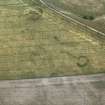
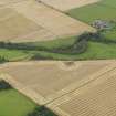
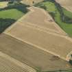
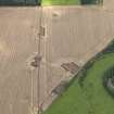
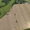
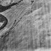
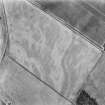
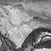
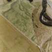
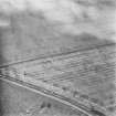
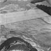
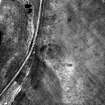
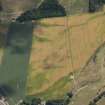
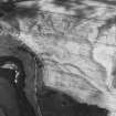
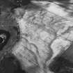
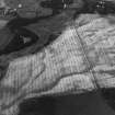
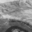
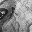
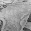
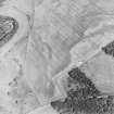
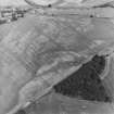
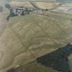
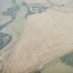
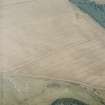
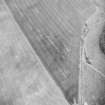
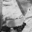
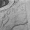
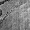
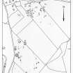
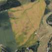
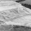
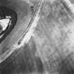
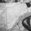
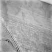
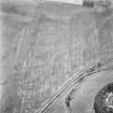
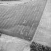
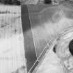
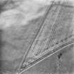
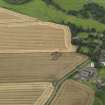
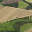
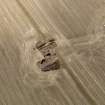
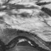
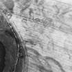
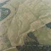
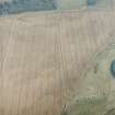
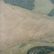
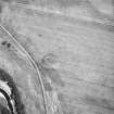
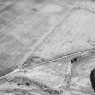
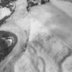
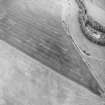
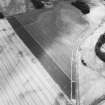
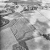
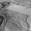
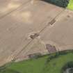
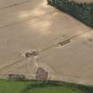
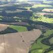
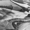
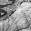
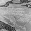
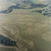
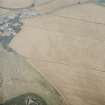
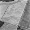
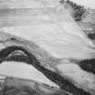
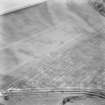
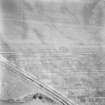
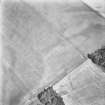
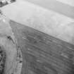
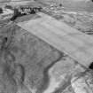
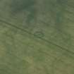
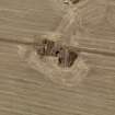
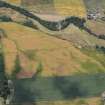
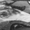
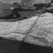
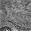
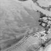
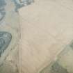
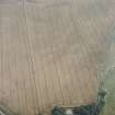
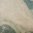
Two arcs of a broad ditch form an oval or near circle with two entrances. The external diameter is c. 22m, and two dark marks near the centre of the circle may represent pits.
J K St Joseph 1976; 1978.
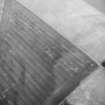
Aerial Photographic Transcription (16 May 1991 - 11 June 1991)
An aerial transcription was produced from oblique aerial photographs. Information from Historic Environment Scotland (BM) 31 March 2017.

