Forteviot
Enclosure (Period Unassigned), Henge (Neolithic) - (Bronze Age)
Site Name Forteviot
Classification Enclosure (Period Unassigned), Henge (Neolithic) - (Bronze Age)
Canmore ID 26562
Site Number NO01NE 30
NGR NO 05347 17055
Datum OSGB36 - NGR
Permalink http://canmore.org.uk/site/26562
First 100 images shown. See the Collections panel (below) for a link to all digital images.
- Council Perth And Kinross
- Parish Forteviot
- Former Region Tayside
- Former District Perth And Kinross
- Former County Perthshire
NO01NE 30 05347 17055
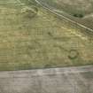
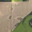
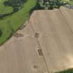
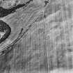
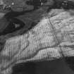
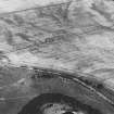
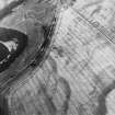
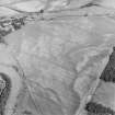
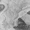
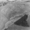
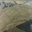
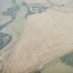
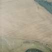
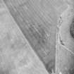
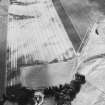
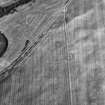
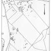
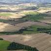
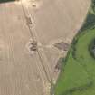
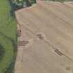
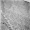
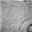
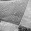
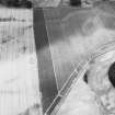
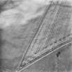
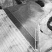
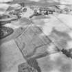
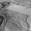
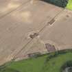
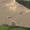
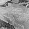
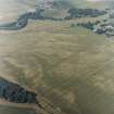
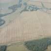
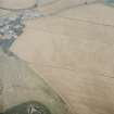
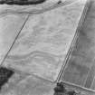
A ring-ditch about 4m wide encloses an area 30m in diameter with a small, narrow ring-ditch at the centre.
J K St Joseph 1976; 1978.
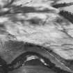
Aerial Photographic Transcription (16 May 1991 - 11 June 1991)
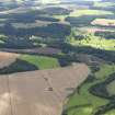
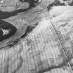
An aerial transcription was produced from oblique aerial photographs. Information from Historic Environment Scotland (BM) 31 March 2017.
Excavation (2 August 2010 - 22 August 2010)
NO 0534 1706 An excavation of the centre and a section of
the ditch of a henge, located outside the palisaded enclosure
(NO01NE 28), undertaken 2–22 August 2010, revealed
features that potentially represented various phases of the
site.
Timber Setting A timber setting composed of at least six
large postholes was uncovered in the centre of the henge.
If contemporary they could have formed a rectangular postbuilt
structure; however, they may simply have been free
standing timbers. The remains of All Over Corded Beaker
pottery was found in the fills of the post-pipes of two of the
posts. Their position suggested deposition after the posts
were removed or had decayed.
Henge The c6m wide by 1.7m deep henge ditch would have
enclosed a 30 x 20m oval area and may have had a causeway
or entrance at its northern end. Sherds of Early Bronze Age
Beaker pottery were recovered from the initial deposits of a
possible ditch terminal. The causeway may have been dug
out at a later date. A glass bead and iron spearhead, both Iron
Age, were recovered from the upper levels of the henge ditch.
A fire pit had been dug into the upper layers of the ditch on
the W side; a small paved area and a large spread of burnt
material were also recorded. The spearhead, bead and pit are
considered indicative of later reuse of the monument.
Cremation and Food Vessel A small stone-lined pit,
containing a cremation burial, laid on a bed of pebbles
was found in the interior of the henge. The cremation was
carefully placed to one side of a unique Early Bronze Age
bowl (Food Vessel), and amongst the burnt bone was found
a single fragment of Beaker pottery, perhaps residual from
earlier activity or possibly deliberately placed.
Central Pit A huge pit, c12 x 5m and up to 2.2m deep, was
recorded in the centre of the henge. Although similar in form
to the central pit excavated in the large henge in 2008 and
2009, the purpose of both of these giant pits remains unclear.
The presence of scattered stonework and pockets of charcoal
in both features suggests rapid but complex backfilling,
and it remains to be seen if this is a clear indication of later
prehistoric or even early medieval interest in the henge.
Archive: Currently University of Glasgow and RCAHMS (intended)
Funder: Historic Scotland, University of Glasgow and University of
Aberdeen
Project (May 2010 - August 2010)
A series of geophysical surveys were carried out over four targeted areas in the main prehistoric ritual complex at Forteviot in May–August 2010. The surveys aimed to confirm the survival of archaeological features identified by aerial photography and identify any other areas of archaeological interest.
NO 0524 1699 Double ditch enclosure A multi-technique geophysical survey was carried out over this feature to assess the capabilities of four near-surface geophysical techniques (earth resistance, gradiometry, ground penetrating radar and EM38) as part of a PhD project. The two ditches of the enclosure were detected by the gradiometer survey. The earth resistance survey detected only the outer ditch of the enclosure and a central pit. The EM38 survey detected the structure after the stripping of the topsoil. The partial GPR survey successfully detected the targeted ditch.
NO 0534 1705 Henge The gradiometer survey carried out in this area clearly detected the wide ditches associated with this structure as well as the central pit.
NO 0547 1746 Square barrows The gradiometer survey carried out in this area identified the central grave of the W barrow but it did not detect any ditches.
NO 0543 1695 Palisaded enclosure A gradiometry survey carried out across the NE corner of the palisaded enclosure suggested the enclosure may have had an accompanying linear ditch in places, and that several of the postholes were burnt in situ. A notable large dipolar anomaly was recorded within the interior of the enclosure.
Archive: RCAHMS (intended)
Funder: NERC, Historic Scotland and University of Glasgow
University of Glasgow, 2010
Magnetometry (May 2010 - August 2010)
NO 0524 1699 Double ditch enclosure. A multi-technique geophysical survey was carried out over this feature to assess the capabilities of four near-surface geophysical techniques (earth resistance, gradiometry, ground penetrating radar and EM38) as part of a PhD project. The two ditches of the enclosure were detected by the gradiometer survey.
NO 0534 1705 Henge. The gradiometer survey carried out in this area clearly detected the wide ditches associated with this structure as well as the central pit.
NO 0547 1746 Square barrows. The gradiometer survey carried out in this area identified the central grave of the W barrow but it did not detect any ditches.
NO 0543 1695 Palisaded enclosure. A gradiometry survey carried out across the NE corner of the palisaded enclosure suggested the enclosure may have had an accompanying linear ditch in places, and that several of the postholes were burnt in situ. A notable large dipolar anomaly was recorded within the interior of the enclosure.
Archive: RCAHMS (intended)
Funder: NERC, Historic Scotland and University of Glasgow
University of Glasgow, 2010
Magnetic Susceptibility (May 2010 - August 2010)
NO 0524 1699 Double ditch enclosure A multi-technique geophysical survey was carried out over this feature to assess the capabilities of four near-surface geophysical techniques (earth resistance, gradiometry, ground penetrating radar and EM38) as part of a PhD project. The EM38 survey detected the structure after the stripping of the topsoil.
Archive: RCAHMS (intended)
Funder: NERC, Historic Scotland and University of Glasgow
University of Glasgow, 2010
Ground Penetrating Radar (May 2010 - August 2010)
NO 0524 1699 Double ditch enclosure A multi-technique geophysical survey was carried out over this feature to assess the capabilities of four near-surface geophysical techniques (earth resistance, gradiometry, ground penetrating radar and EM38) as part of a PhD project. The partial GPR survey successfully detected the targeted ditch.
Archive: RCAHMS (intended)
Funder: NERC, Historic Scotland and University of Glasgow
University of Glasgow, 2010
Earth Resistance Survey (May 2010 - August 2010)
NO 0524 1699 Double ditch enclosure A multi-technique geophysical survey was carried out over this feature to assess the capabilities of four near-surface geophysical techniques (earth resistance, gradiometry, ground penetrating radar and EM38) as part of a PhD project. The earth resistance survey detected only the outer ditch of the enclosure and a central pit.
Archive: RCAHMS (intended)
Funder: NERC, Historic Scotland and University of Glasgow
University of Glasgow, 2010


