
Pricing Change
New pricing for orders of material from this site will come into place shortly. Charges for supply of digital images, digitisation on demand, prints and licensing will be altered.
John's Hill


Enclosure (Period Unassigned)
Site Name John's Hill
Classification Enclosure (Period Unassigned)
Alternative Name(s) Corb
Canmore ID 26491
Site Number NO00NW 2
NGR NO 0013 0810
Datum OSGB36 - NGR
Permalink http://canmore.org.uk/site/26491


- Council Perth And Kinross
- Parish Dunning
- Former Region Tayside
- Former District Perth And Kinross
- Former County Perthshire
NO00NW 2 0013 0810
(NO 0014 0810) Circular enclosure.
Visible on RAF air photographs 106G/Scot/UK 120: 4383-4: flown 20 June 1946.
(Undated) information on OS antiquity record card.
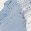
NO 0013 0810. This possible ring enclosure on the summit of John's Hill, at a height of almost 1,550', commands extensive views in all directions.
It consists of a turf bank enclosing a featureless area c. 31.5m in diameter. The bank measures 3.0m in width and 0.4m in height externally, the counterscarp now reduced almost to ground level, with traces of a shallow runnel around the top which could be either a palisade trench or a sheep walk.
Surveyed at 1:2500.
Visited by OS (R D) 20 December 1967.
A ring work, as described by previous OS field surveyor. It is of uncertain date and purpose, but is certainly not recent from its situation and condition in relation to recent enclosures in the valley below.
Visited by OS (D W R) 20 May 1974.
(Name cited as John's Hill). Scheduled as a 'ring enclosure of prehistoric date, visible as an earthwork'.
Information from Historic Scotland, scheduling document dated 11 December 2002.
(Name cited as John's Hill). Scheduled as a 'enclosure 1.22km SW of Corb... the remains of a circular enclosure of later prehistoric date, visible as an earthwork'.
Information from Historic Scotland, scheduling document dated 24 December 2009.
Project (1 May 2016 - 12 May 2017)
Archaeological features were identified and mapped from airborne remote sensing sources, such as lidar, historic vertical aerial photographs, and 25cm orthophotographs.
Information from HES (OA) 12 May 2017
Watching Brief (1 June 2022 - 30 January 2023)
NO 00153 08739 An archaeological watching brief was carried out at Coulshill near Dunning across a proposed tree plantation area close to where there are two known Scheduled Monuments: St John’s Hill enclosure (NO00NW 2) and Coulshill hut circle and enclosure (NN90NE 5). The watching brief monitored all ground breaking works where earthworks and dykes needed to be breached as part of construction. A total of 27 dykes or field boundaries made of redeposited topsoil and turf were excavated measuring 680 m². No significant archaeological features or finds were identified during the watching brief.
Information from GUARD Archaeology Ltd.

