
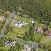
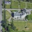
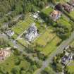
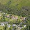
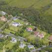
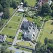
Helensburgh, Upper Colquhoun Street, The Hill House, Outbuilding


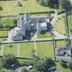
Garage (Modern), Outbuilding (Period Unassigned)
Site Name Helensburgh, Upper Colquhoun Street, The Hill House, Outbuilding
Classification Garage (Modern), Outbuilding (Period Unassigned)
Canmore ID 264653
Site Number NS38SW 17.01
NGR NS 30030 83868
Datum OSGB36 - NGR
Permalink http://canmore.org.uk/site/264653


- Council Argyll And Bute
- Parish Rhu
- Former Region Strathclyde
- Former District Dumbarton
- Former County Dunbartonshire

