 |
On-line Digital Images |
SC 435526 |
Papers of Professor John R Hume, economic and industrial historian, Glasgow, Scotland |
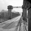
Ballinluig Viaduct
General view along main spans |
5/1974 |
Item Level |
|
 |
On-line Digital Images |
SC 435527 |
Papers of Professor John R Hume, economic and industrial historian, Glasgow, Scotland |
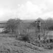
Ballinluig Viaduct
General view |
5/1974 |
Item Level |
|
 |
On-line Digital Images |
SC 435529 |
Papers of Professor John R Hume, economic and industrial historian, Glasgow, Scotland |
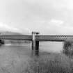
Ballinluig Viaduct
General view |
5/1974 |
Item Level |
|
 |
On-line Digital Images |
SC 435530 |
Papers of Professor John R Hume, economic and industrial historian, Glasgow, Scotland |
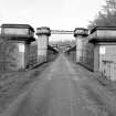
View of Ballinluig Railway Viaduct along former trackbed after conversion for use as a road.
This viaduct now carries the A 827 public road across the River Tummel. |
5/1974 |
Item Level |
|
 |
On-line Digital Images |
DP 093180 |
RCAHMS Aerial Photography Digital |
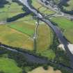
General oblique aerial view of Logierait Mill and the cropmarks of the rig, looking to the N. |
23/7/2010 |
Item Level |
|
 |
On-line Digital Images |
DP 093181 |
RCAHMS Aerial Photography Digital |
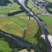
General oblique aerial view of Logierait Mill and the cropmarks of the rig, looking to the NNW. |
23/7/2010 |
Item Level |
|
 |
On-line Digital Images |
DP 227097 |
Historic Environment Scotland |
General oblique aerial view of the River Tay at its confluence with the River Tummel with the Ballnluig Viaduct in the foreground, looking SSW. |
25/11/2015 |
Item Level |
|
 |
On-line Digital Images |
DP 227098 |
Historic Environment Scotland |
General oblique aerial view of the River Tay at its confluence with the River Tummel with the Ballnluig Viaduct in the foreground, looking SSW. |
25/11/2015 |
Item Level |
|
 |
On-line Digital Images |
SC 1653417 |
List C Survey |
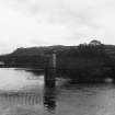
Ballinluig Railway Viaduct.
View of viaduct. |
1975 |
Item Level |
|
 |
On-line Digital Images |
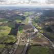
DP 275682 |
Historic Environment Scotland |
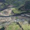
Oblique aerial view. |
20/4/2018 |
Item Level |
|
 |
On-line Digital Images |
DP 275683 |
Historic Environment Scotland |
Oblique aerial view. |
20/4/2018 |
Item Level |
|
 |
On-line Digital Images |
SC 2393622 |
Records of the Ordnance Survey, Southampton, Hampshire, England |
Ballinluig Viaduct, NN95SE 18, Ordnance Survey index card, Recto |
c. 1958 |
Item Level |
|