Caisteal Dubh
Castle (Medieval)
Site Name Caisteal Dubh
Classification Castle (Medieval)
Alternative Name(s) Black Castle Of Moulin; An Sean Chaisteal; Caisteal Dubh Mhaothlinne; Moulin Castle; Pitlochry
Canmore ID 26274
Site Number NN95NW 1
NGR NN 9470 5892
Datum OSGB36 - NGR
Permalink http://canmore.org.uk/site/26274
- Council Perth And Kinross
- Parish Moulin
- Former Region Tayside
- Former District Perth And Kinross
- Former County Perthshire
NN95NW 1 9470 5892
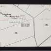
(NN 9470 5892) Caisteal Dubh (NR) (In Ruins)
OS 6" map, Perthshire, 2nd ed., (1900)
Known as 'An Sean Chaisteal' and 'Caisteal Dubh Mhaothlinne'.
NSA 1845.
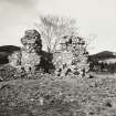
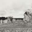
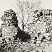
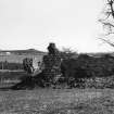
This 13th century castle has been about 110' N-S by 85' E-W. The walls of the quadrangle are 6' thick and have probably been nearly 30' high. The only round tower remaining is at the NW angle and the walls are fragmentary (MacGibbon and Ross 1887-92).
The castle is supposed to have stood on an enlarged crannog in the centre of a lake but was probably merely moated. The remains of a stone path lead from Balnadrum farm towards the castle (Dixon 1925).
D MacGibbon and T Ross 1887-92; J M Dixon 1925.
Caisteal Dubh was built about 1326 on an island, or crannog, in a lake, and a landing place for boats, a causeway, was uncovered at Balnadrum some years ago. It was inhabited until 1500, when traditionally it was fired because of fear of plague. The lake was drained about 1720, but remained a marsh for 100 years.
H Mitchell 1923.
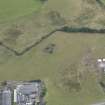
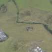
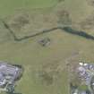
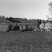
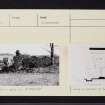
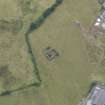
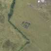
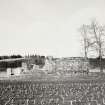
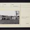
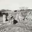
Still known as Caisteal Dubh, this early castle survives in a poor and ruinous condition in a cultivated field, and is generally as planned by MacGibbon and Ross (1887-92). The foundation of the SW tower is now visible, and another internal wall.
There is no trace of a moat, nor of a crannog. There is little doubt, however, that the area was once a loch, and the castle stands on a slight rise, which would have been either the end of a low peninsula, or a very shallow point in the water. There is no knowledge now of the alleged causeway.
Surveyed at 1:2500.
Visited by OS (A A) 11 April 1975.
NN 9465 5875 An evaluation was undertaken in July 2005 prior to the construction of housing. The site was located on a rise 200m to the SW of Caisteal Dubh (NN95NW 1), a 13th-century castle in the vicinity of a possible souterrain (NN95NW 3), and on the edge of a small loch drained in the early 18th century.
Eight trenches were machine-excavated across the site, equating to 290m of linear trenching. Only one feature of archaeological significance was discovered; a possible 18th-century rubble field drain that may relate to the draining of the loch, following the lowest contour of the rise.
Report to be lodged with Perth and Kinross SMR and NMRS.
Sponsor: Classic Experiences Pitlochry Ltd.
K Clapperton 2005
Field Visit (16 October 1942)
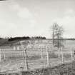
This site was included within the RCAHMS Emergency Survey (1942-3), an unpublished rescue project. Site descriptions, organised by county, vary from short notes to lengthy and full descriptions and are available to view online with contemporary sketches and photographs. The original typescripts, manuscripts, notebooks and photographs can also be consulted in the RCAHMS Search Room.
Information from RCAHMS (GFG) 10 December 2014.


