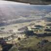
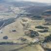
Accessibility

Font Size

100% 150% 200%

Background Colour

Default Contrast
Close Reset

Glen Garry

General View (Period Unassigned)

Site Name Glen Garry

Classification General View (Period Unassigned)

Canmore ID 262656

Site Number NN86NW 42

NGR NN 8098 6561

Datum OSGB36 - NGR

Permalink http://canmore.org.uk/site/262656

Ordnance Survey licence number AC0000807262. All rights reserved.
Canmore Disclaimer. © Bluesky International Limited 2025. Public Sector Viewing Terms

Toggle Aerial | View on large map

Digital Images

General oblique aerial view of the glen with the country house, dairy and walled garden adjacent, taken from the ENE.
General oblique aerial view of the glen with the country house, dairy and walled garden adjacent, taken from the ENE.General oblique aerial view of the A9 road looking along Glen Garry towards the Grampian Mountains, taken from the SE.General oblique aerial view of the glen with the country house, walled garden, cottages and farm adjacent, taken from the NEGeneral oblique aerial view looking across the farmsteads and along Glen Garry, taken from the ESE.General oblique aerial view looking along Glen Garry towards the Grampian mountains, taken from the ESE.General oblique aerial view of the glen with the village adjacent and the Grampian Mountains in the distance, taken from the SE.General oblique aerial view of the A9 road looking along Glen Garry towards the Grampian Mountains, taken from the SE.General oblique aerial view of the glen with the village adjacent and the Grampian Mountains in the distance, taken from the ESE.General oblique aerial view of the glen with the village adjacent and the Grampian Mountains in the distance, taken from the SE.General oblique aerial view of the A9 road looking along Glen Garry towards the Grampian Mountains, taken from the ESE.General oblique aerial view of the A9 road looking along Glen Garry towards the Grampian Mountains, taken from the E.General oblique aerial view of the glen with the country house and dairy adjacent, taken from the E.General oblique aerial view looking along Glen Garry towards the Grampian mountains, taken from the ESE.General oblique aerial view of the A9 road looking along Glen Garry towards the Grampian Mountains, taken from the ESE.General oblique aerial view of the glen with the country house and dairy adjacent, taken from the ENE.General oblique aerial view of the glen with the country house and dairy adjacent, taken from the E.

Administrative Areas

  • Council Perth And Kinross
  • Parish Blair Atholl
  • Former Region Tayside
  • Former District Perth And Kinross
  • Former County Perthshire

References

MyCanmore Image Contributions


Contribute an Image

MyCanmore Text Contributions