Pricing Change
New pricing for orders of material from this site will come into place shortly. Charges for supply of digital images, digitisation on demand, prints and licensing will be altered.
Kindallachan
Pit(S) (Period Unassigned)(Possible), Standing Stone (Prehistoric)
Site Name Kindallachan
Classification Pit(S) (Period Unassigned)(Possible), Standing Stone (Prehistoric)
Alternative Name(s) Druid's Stone
Canmore ID 26228
Site Number NN94NE 7
NGR NN 9938 4994
Datum OSGB36 - NGR
Permalink http://canmore.org.uk/site/26228
- Council Perth And Kinross
- Parish Dunkeld And Dowally
- Former Region Tayside
- Former District Perth And Kinross
- Former County Perthshire
NN94NE 7 9938 4994
See also NN95SE 15.
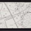
NN 9938 4994. A standing stone, known locally as the 'Druid's Stone' (see NN95SE 15).
Visited by OS Reviser (M R Hunter) September 1975.
Scheduled as Kindallachan, standing stone.
Information from Historic Scotland, scheduling document dated 14 January 2002.
Geophysical Survey (27 September 2017 - 28 September 2017)
AOC Archaeology Group was commissioned by Jacobs UK Limited, on behalf of Transport Scotland with Historic Environment Scotland as the Curator, to undertake an archaeological geophysical survey (Magnetometer and Earth Resistance) to investigate the potential for buried archaeological remains along the proposed A9 Dualling Southern Section, Scotland.
Two parcels of land were outlined for geophysical survey, covering an area of approximately 0.43 hectares. A magnetometer and earth resistivity survey were undertaken over land at Kindallachan cairn (centred at NN 9948 4973) and a magnetometer survey was undertaken on land at Kindallachan standing stone (centred at NN 9938 4994).
The results of the gradiometer survey, conducted between 27th and 28th September, 2017, located a linear anomaly, possibly of archaeological origin, in the location of the Kindallachan cairn. This anomaly could represent part of the cairn itself or relate to a possible prehistoric kerb around the cairn. Further linear trends were identified across the data for both parcels that are more discrete and tentative and have an unclear origin.
Magnetic disturbance and ferrous anomalies were also identified.
The results of the earth resistance survey positively identified the western extents of the Kindallachan cairn, displaying a sub-circular area of high resistance. Further areas of low resistance were identified which could relate to archaeology but could also relate to vegetation or geological changes in the ground surrounding the cairn.
Information from: Kimberley Teale (AOC Archaeology) 31st October 2017
OASIS ID: aocarcha1-301021


