
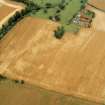
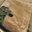
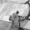
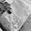
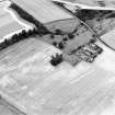
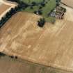
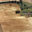
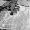
Abbey, Old School, Central Building


School (18th Century)
Site Name Abbey, Old School, Central Building
Classification School (18th Century)
Canmore ID 262198
Site Number NT57SW 363.01
NGR NT 53333 74669
Datum OSGB36 - NGR
Permalink http://canmore.org.uk/site/262198


- Council East Lothian
- Parish Haddington
- Former Region Lothian
- Former District East Lothian
- Former County East Lothian
NT57SW 363.01 53333 74669
The building is substantially ruinous, in two parts of sandstone rubble.
Historic Scotland Listing document.

