
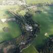
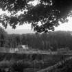
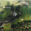
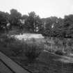
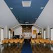
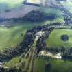
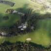
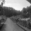
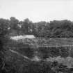
Black Barony, Walled Garden


Cottage (Period Unassigned), Glasshouse (19th Century) - (20th Century), Sundial (Period Unassigned), Walled Garden (Period Unassigned)
Site Name Black Barony, Walled Garden
Classification Cottage (Period Unassigned), Glasshouse (19th Century) - (20th Century), Sundial (Period Unassigned), Walled Garden (Period Unassigned)
Alternative Name(s) Darn Hall; Darnhall; Black Barony Castle; Blackbarony Castle; Hotel
Canmore ID 262122
Site Number NT24NW 18.06
NGR NT 23849 47457
Datum OSGB36 - NGR
Permalink http://canmore.org.uk/site/262122


- Council Scottish Borders, The
- Parish Eddleston
- Former Region Borders
- Former District Tweeddale
- Former County Peebles-shire
NT24NW 18.06 23849 67457

