
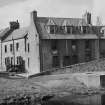
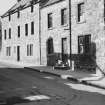
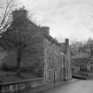
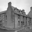
Jedburgh, 42 Canongate


Building (Post Medieval) - (Modern)
Site Name Jedburgh, 42 Canongate
Classification Building (Post Medieval) - (Modern)
Canmore ID 260876
Site Number NT62SE 245
NGR NT 65226 20587
Datum OSGB36 - NGR
Permalink http://canmore.org.uk/site/260876


- Council Scottish Borders, The
- Parish Jedburgh
- Former Region Borders
- Former District Roxburgh
- Former County Roxburghshire
NT62SE 245 65226 20587
NMRS REFERENCE
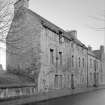
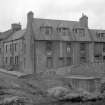
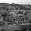
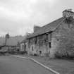
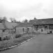
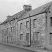
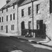
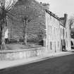
Central Redevelopment Area, demolished c. 1965.
Depicted on the 1st and 2nd editions of the O.S. 6-inch maps (Roxburghshire), 1863, 1899, sheet XXI, NW.
Information from RCAHMS (SM), 14 December 1999.
Photographic Survey (April 1962)
Photographic survey of buildings in Jedburgh, Roxburghshire, by the Scottish National Buildings Record in 1962.
Photographic Survey (1964)
Photographic survey of buildings in Jedburgh, Roxburghshire, by the Scottish National Buildings Record/Ministry of Work in 1964.

