Accessibility

Font Size

100% 150% 200%

Background Colour

Default Contrast
Close Reset

South Mains, Innerpeffray

Cropmark(S) (Period Unknown), Field System (Period Unassigned), Pit(S) (Period Unassigned)

Site Name South Mains, Innerpeffray

Classification Cropmark(S) (Period Unknown), Field System (Period Unassigned), Pit(S) (Period Unassigned)

Canmore ID 26021

Site Number NN91NW 31

NGR NN 903 179

Datum OSGB36 - NGR

Permalink http://canmore.org.uk/site/26021

Ordnance Survey licence number AC0000807262. All rights reserved.
Canmore Disclaimer. © Bluesky International Limited 2025. Public Sector Viewing Terms

Toggle Aerial | View on large map

Digital Images

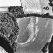
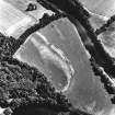
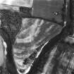
South Mains, Innerpeffray, oblique aerial view, taken from the WSW, centred on cropmarks including those of pits. Innerpeffray Castle is visible in the top right-hand corner of the photograph.
South Mains, Innerpeffray, oblique aerial view, taken from the WSW, centred on cropmarks including those of pits. Innerpeffray Castle is visible in the top right-hand corner of the photograph.South Mains, Innerpeffray, oblique aerial view, taken from the N, centred on cropmarks including those of pits.Oblique aerial view.South Mains, Innerpeffray, oblique aerial view, taken from the NE, centred on cropmarks including those of pits.Oblique aerial view.South Mains, Innerpeffray, oblique aerial view, taken from the WNW, centred on cropmarks including those of pits. Innerpeffray Castle is visible in the top left-hand corner of the photograph.Oblique aerial view.South Mains, Innerpeffray, NN91NW 31, Ordnance Survey index card, RectoSouth Mains, Innerpeffray, NN91NW 31, Ordnance Survey index card, Recto

Administrative Areas

  • Council Perth And Kinross
  • Parish Crieff
  • Former Region Tayside
  • Former District Perth And Kinross
  • Former County Perthshire

Archaeology Notes

NN91NW 31 903 179.

Aerial photography has revealed a series of cropmarks, including pits, and a field-system, across a promontory within a meander of the River Earn immediately to the SW of South Mains farmstead (NN91NW 64). The pits are relatively large (2-3m in diameter) and the majority of them run along the edge of the promontory, in a zig-zag alignment, which is also followed by a intermittent linear cropmark. Further cropmarks on the promontory include an arc of ditch (NN c.9019 1799), indeterminate markings, and a series of adjoining sub-rectangular enclosures representing a field-system. A further concentration of cropmarks, with no clear form, are visible 70m to the S below the promontory.

Information from RCAHMS (KB) 26 August 1999

References

MyCanmore Image Contributions


Contribute an Image

MyCanmore Text Contributions