Pricing Change
New pricing for orders of material from this site will come into place shortly. Charges for supply of digital images, digitisation on demand, prints and licensing will be altered.
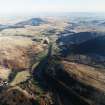
Glendevon Castle
Tower House (17th Century)(Possible)
Site Name Glendevon Castle
Classification Tower House (17th Century)(Possible)
Canmore ID 25896
Site Number NN90NE 1
NGR NN 97656 05494
Datum OSGB36 - NGR
Permalink http://canmore.org.uk/site/25896
- Council Perth And Kinross
- Parish Glendevon
- Former Region Tayside
- Former District Perth And Kinross
- Former County Perthshire
NN90NE 1 97656 05494
(NN 9763 0549) Glendevon Castle (NR)
OS 6" map, (1958).
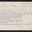
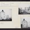
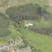
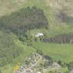
A much altered fortalice, now a farmhouse, dating mainly from the early 17th century. It is on the Z-plan, consisting of a main block with a square tower projecting at the north end and another in the opposite direction at the south. Only the south tower remains complete, the building being lowered and finished in a mixture of lean-to slating and sham crenellations.
The east wall of the main block is 9ft thick - an indication that it contains the remains of a much earlier castle - apparently a massive oblong tower or keep, possibly of the 15th century.
N Tranter 1962-70.
Generally as described by Tranter, Glendevon Castle has been converted into licensed premises and a dwelling house, retaining much of its original 15th and 17th century architecture.
A plaque states that the castle was built as a keep by the Red Douglas around 1442.
Visited by OS (R D), 28 June 1967.
Much altered Z-plan tower house, probably early 17th century, but likely to contain earlier fabric, Only SW jamb with circular turret survives to full
height, but with modern porch in re-entrant angle and apex stack removed; remaining 2 ranges lowered ('1766) in height with monopitch roofs and dummy crenellations. White-harled, some exposed margins; roofs slated and minus screws/crow-steps. Low lean-to at E reconstructed 1966.
1766 datestone with motto and initialed (R(utherford). Reinstated 13th Amendment (Historic Scotland)


