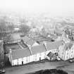
Kirkwall, 32 Broad Street
House (19th Century)
Site Name Kirkwall, 32 Broad Street
Classification House (19th Century)
Alternative Name(s) 1 Palace Road
Canmore ID 2577
Site Number HY41SW 62
NGR HY 44879 10842
Datum OSGB36 - NGR
Permalink http://canmore.org.uk/site/2577
- Council Orkney Islands
- Parish Kirkwall And St Ola
- Former Region Orkney Islands Area
- Former District Orkney
- Former County Orkney
Watching Brief (3 September 2019 - 15 January 2020)
HY 44859 10842 An archaeological watching brief was undertaken by ORCA Archaeology during works to replace road and footway surfaces in Kirkwall town centre, undertaken as part of the Kirkwall Townscape Heritage Initiative project. the works were divided into three Areas; this entry covers Area 3. The groundworks on Broad Street exposed a series of substantial remains interpreted as being those shown on the First Edition (1882) Ordnance Survey map. The buildings depicted have been regarded as surviving remnants of the Cathedral precincts which once occupied the area bounded by St Magnus Cathedral, the Bishop's Palace and the sea, and now occupied by the north end of Victoria Street and Palace Gardens. The largest single structure exposed occupied the footprint of one building depicted both on the Ordnance Survey map and a view of Broad Street dating from 1780, and has been interpreted as the remains of the Chaplain's Chamber and sub-Dean's Manse.
Structural remains. matching the footprint of those buildings on early Ordnance Survey maps, were also identified along Palace Road, but it is unclear if these related to structures contemporary with those of the Cathedral precinct. Further structures were also exposed and a number of these were clearly drains, particularly those around the frontages of Tankerness House Museum and 32 Broad Street. The deposits exposed throughout the groundworks clearly represented the complex history of the site and were a mix of natural tills, former land surfaces, dumped and redeposited material, and modern truncations. The archaeological features exposed remain in-situ underlying the modern road surface and make up layers.
Information from Orkney Research Centre for Archaeology (ORCA).


