Pricing Change
New pricing for orders of material from this site will come into place shortly. Charges for supply of digital images, digitisation on demand, prints and licensing will be altered.
Ross Point
Non Antiquity(S)
Site Name Ross Point
Classification Non Antiquity(S)
Canmore ID 257400
Site Number NT96SE 24
NGR NT 96424 60443
Datum OSGB36 - NGR
Permalink http://canmore.org.uk/site/257400
- Council Scottish Borders, The
- Parish Mordington
- Former Region Borders
- Former District Berwickshire
- Former County Berwickshire
NT96SE 24 94624 60443
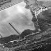
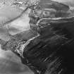
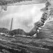
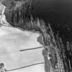
These soilmarks are situated in a cultivated field on the top of the north-east facing cliffs to the south-east of Cowdrait and have been recorded on oblique aerial photographs (RCAHMSAP 1999). Measuring about 190 metres long and 5 metres wide, the soilmarks describe an irregular and broken arc that may be geological in origin because they respect the contour changes of the terrain at the cliff's edge, rather than cut across it.
Information from RCAHMS (SWC) 24 May 2004.


