Lundin
Cairn (Period Unassigned), Cup Marked Stone (Prehistoric), Four Poster Stone Circle (Bronze Age), Beaker(S) (Period Unassigned)
Site Name Lundin
Classification Cairn (Period Unassigned), Cup Marked Stone (Prehistoric), Four Poster Stone Circle (Bronze Age), Beaker(S) (Period Unassigned)
Alternative Name(s) Aberfeldy
Canmore ID 25727
Site Number NN85SE 9
NGR NN 8806 5056
Datum OSGB36 - NGR
Permalink http://canmore.org.uk/site/25727
- Council Perth And Kinross
- Parish Logierait
- Former Region Tayside
- Former District Perth And Kinross
- Former County Perthshire
NN85SE 9 8806 5056
(NN 8806 5056) Stone Circle (NR)
OS 6" map (1902)
At NN 8807 5054, nearby, is a cup marked stone bearing 43 cups, and sited approximately 42' SE from the centre of the stone setting. There is, however, nothing to confirm contemporaneity.
F R Coles 1908; J H Dixon 1922.
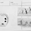
Four standing stones (7'3", 4'8", 4'10" and 3'9" respectively above turf level) sit on the rim of an artificially flattened gravel knoll, defining an area 17' in diameter; the knoll has been disturbed by recent dumping of material from an artificial water channel on the S side. Excavated by the Breadalbane Arch Soc (c.1964), the knoll was found to incorporate spread cairn material and to be partially surrounded by a ditch; within the enclosed area was a nearly central pit with fragments of burnt bone and wood, and other fragmentary evidences of cremation. Pieces of 'B' beaker and a collared urn (the only datable material) and some small fragments of undecorated pot were found among the cairn material (plan by Stewart also shows five standing stones).
M E C Stewart 1967.
Burl, classifying the "Stone Circle" as a "Four-Poster", built on a mound, gives a sequence of activities starting with the deturfing of the site, the top of the mound being hollowed and a demarcation ditch being dug around it. A pit was then dug in the centre in which cremated bone was deposited and the pit refilled. Finally the four stones were erected around the edge of the hollowed area and the hollow filled with cairn material. A second cremation was found at the foot of the NW stone. Cremated bone was also scattered over the whole of the central area. In the cairn material within and just outside the stone setting were found several sherds of a collared urn and an incomplete cord-ornamented beaker. The presence of the latter (which Clarke states is now in the National Museum of Antiquities of Scotland (NMAS) is so anomalous that its presence might be best explained as having been placed in the earlier cairn long before the erection of the 4-Poster, or it may be the redisposition of a treasured and attractive pot. Burl suggests a date of c.1800 BC for 4-Posters.
D L Clarke 1970; H A W Burl 1971.
A 'four-poster' set on top of a small knoll, which is at least in part artificial. The ditch noted by the excavators is not visible. The cup marked stone to the SE is as illustrated by Dixon and has the appearance of having been cast aside when the distillery dam was constructed.
Surveyed at 1:2500.
Visited by OS (SFS) 12 December 1975.
Field Visit (16 August 1942)
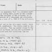
This site was included within the RCAHMS Emergency Survey (1942-3), an unpublished rescue project. Site descriptions, organised by county, vary from short notes to lengthy and full descriptions and are available to view online with contemporary sketches and photographs. The original typescripts, manuscripts, notebooks and photographs can also be consulted in the RCAHMS Search Room.
Information from RCAHMS (GFG) 10 December 2014.
Publication Account (1987)
Several sites may be seen between the junction with the main road and the interesting setting of standing stones excavated by Dr M E C Stewart. The first is a small standing stone set up in an unusually inconspicuous position (NN 878506) - perhaps it indicates the site of a burial. Nearby there is a pair of standing stones, a class of monument showing a distinct distribution in the valleys of the Tay and the Earn, but with outlying examples such as Orwell (no. 101). The stones, set on an east-west alignment, are not tall, measuring 0.6m in height and 1m by 0.3m at the base, and 1.1m in height and 1.8m by 0.46m at the base respectively.
The visitor should continue along the track and will find the setting of four standing stones to the southeast; this is a 'four-poster' setting of stones on the top of a natural mound. The stones were erected around a deposit of cremated bone, pottery and burnt wood; finally cairn material was heaped over the interior, spilling out beyond the standing stones. The pottery includes sherds of a fine cord-ornamented Beaker and a Collared Cinerary Urn; they may well represent prolonged activity on the site rather than a short period of burial ritual.
Information from ‘Exploring Scotland’s Heritage: Fife and Tayside’, (1987).
Watching Brief (5 June 2018 - 6 June 2018)
At NN 8806 5056 are four standing stones forming a small circle sat on artificially levelled ground. It is a Scheduled Ancient Monument (SM1563).
The site was partially excavated in 1964 when a central pit containing burnt bone was identified. Although the site remains to be interpreted satisfactorily, it appears likely that the sequence of events at this site began with a pit being dug on the mound and cremated bone deposited in it. Thereafter the pit was refilled and the stones erected.
A second cremation was found at the base of one of the stones and sherds of a corded beaker and a collared urn were also identified within the circle. However, the precise sequence of events at this spot remains unclear.
Some 12m to the south-east of the standing stones is a large cup-marked rock bearing 43 cups.
The existing overhead line runs directly over this monument.
Information from Oasis (scotiaar1-321801) 18 July 2018


