
Pricing Change
New pricing for orders of material from this site will come into place shortly. Charges for supply of digital images, digitisation on demand, prints and licensing will be altered.
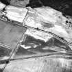
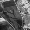
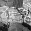
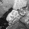
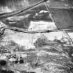
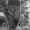
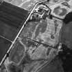
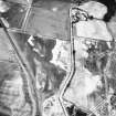
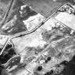
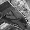
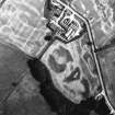
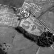
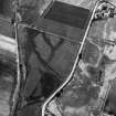
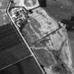
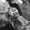
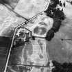
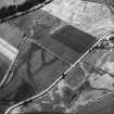
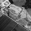
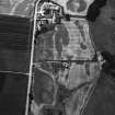
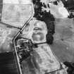
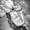
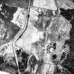
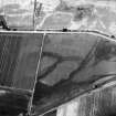
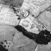
Castle Menzies


Linear Feature(S) (Period Unassigned), Pit(S) (Period Unassigned), Unenclosed Settlement (Period Unassigned)
Site Name Castle Menzies
Classification Linear Feature(S) (Period Unassigned), Pit(S) (Period Unassigned), Unenclosed Settlement (Period Unassigned)
Alternative Name(s) Castle Menzies, Home Farm
Canmore ID 25659
Site Number NN84NW 47
NGR NN 8333 4942
Datum OSGB36 - NGR
Permalink http://canmore.org.uk/site/25659


- Council Perth And Kinross
- Parish Weem
- Former Region Tayside
- Former District Perth And Kinross
- Former County Perthshire
NN84NW 47 8333 4942
Scheduled as [Castle Menzies], Home Farm, unenclosed settlements. Locations indicated at NN c. 8335 4940 (sched no 7750) and NN 8325 4948 (sched no 7757) respectively.
Information from Historic Scotland, scheduling documents dated 28 February 2000.

