
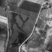
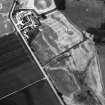
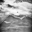
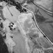
Castle Menzies


Palisaded Enclosure(S) (Period Unassigned), Roundhouse(S) (Prehistoric), Souterrain(S) (Prehistoric)
Site Name Castle Menzies
Classification Palisaded Enclosure(S) (Period Unassigned), Roundhouse(S) (Prehistoric), Souterrain(S) (Prehistoric)
Alternative Name(s) Castle Menzies, Home Farm
Canmore ID 25658
Site Number NN84NW 46
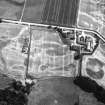
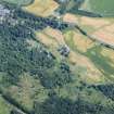
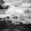
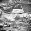
NGR NN 8352 4930
Datum OSGB36 - NGR
Permalink http://canmore.org.uk/site/25658


- Council Perth And Kinross
- Parish Weem
- Former Region Tayside
- Former District Perth And Kinross
- Former County Perthshire
NN84NW 46 8352 4930
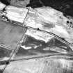
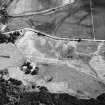
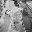
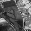
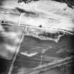
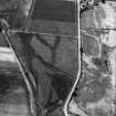
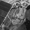
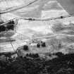
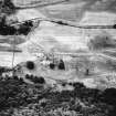
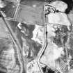
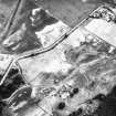
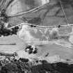
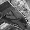
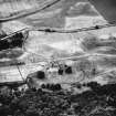
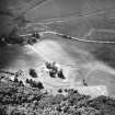
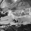
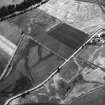
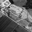
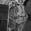
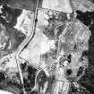
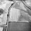
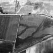
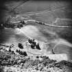
Scheduled as [Castle Menzies], Home Farm, settlement and souterrains. Location indicated at NN c. 8354 4932.
Information from Historic Scotland, scheduling document dated 28 February 2000.

