
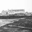
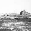
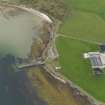
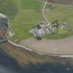
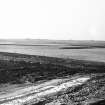
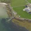
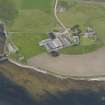
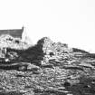
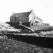
Tankerness, Hall Of Tankerness, Fishing Station, Pier


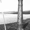
Pier (Period Unassigned)
Site Name Tankerness, Hall Of Tankerness, Fishing Station, Pier
Classification Pier (Period Unassigned)
Canmore ID 256334
Site Number HY50NW 42.03
NGR HY 52294 08559
Datum OSGB36 - NGR
Permalink http://canmore.org.uk/site/256334


- Council Orkney Islands
- Parish St Andrews And Deerness
- Former Region Orkney Islands Area
- Former District Orkney
- Former County Orkney
HY50NW 42.03 52294 08559

