
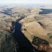
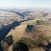
Down Hill


Field System (Period Unassigned), Rig And Furrow (Medieval) - (Post Medieval)
Site Name Down Hill
Classification Field System (Period Unassigned), Rig And Furrow (Medieval) - (Post Medieval)
Canmore ID 254796
Site Number NO00SW 64
NGR NO 0037 0343
NGR Description Centred on NO 0037 0343
Datum OSGB36 - NGR
Permalink http://canmore.org.uk/site/254796


- Council Perth And Kinross
- Parish Glendevon
- Former Region Tayside
- Former District Perth And Kinross
- Former County Perthshire
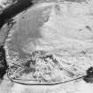
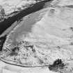
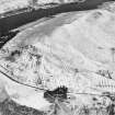
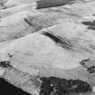
NO00SW 64 centred on 0037 0343
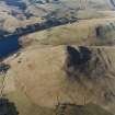
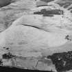
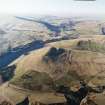
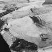
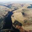
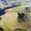
There is a network of earthen banked fields at the foot of the steep slopes on the SE flank of Down Hill. Sinuous rig, some of which has been subdivided, can be seen within the enclosures. One of the field-banks may overlie a patch of rig, which extends beyond the limits of the enclosures. A small oval enclosure, possibly for stock, abuts the N, upslope, side of one of the field-banks. Some of the field-banks extend into the improved ground to the SE.
Information from RCAHMS (DCC) 2 December 2003
Project (1 May 2016 - 12 May 2017)
Archaeological features were identified and mapped from airborne remote sensing sources, such as lidar, historic vertical aerial photographs, and 25cm orthophotographs.
Information from HES (OA) 12 May 2017

