Accessibility

Font Size

100% 150% 200%

Background Colour

Default Contrast
Close Reset

Hoy, Lyness, Rinnigill Gas Plant

Building (20th Century)

Site Name Hoy, Lyness, Rinnigill Gas Plant

Classification Building (20th Century)

Alternative Name(s) Scapa Flow

Canmore ID 252859

Site Number ND39SW 18.03

NGR ND 31842 93679

Datum OSGB36 - NGR

Permalink http://canmore.org.uk/site/252859

Ordnance Survey licence number AC0000807262. All rights reserved.
Canmore Disclaimer. © Bluesky International Limited 2025. Public Sector Viewing Terms

Toggle Aerial | View on large map

Digital Images

Oblique aerial view centred on the gas plant with the floating crane adjacent, taken from the E.
Oblique aerial view centred on the gas plant with the floating crane adjacent, taken from the E.View of Rinnigill gas plant, Lyness, Hoy, from SHoy, Crockness, oblique aerial view, taken from the ESE, centred on the Martello Tower and a curving linear soilmark, and showing Rinnigill Military Camp and a crane in the background.Oblique aerial view centred on the gas plant with the floating crane adjacent, taken from the NW.Hoy, Crockness, oblique aerial view, taken from the ESE, centred on the Martello Tower and a curving linear soilmark, and showing Rinnigill Military Camp and a crane in the background.Hoy, Rinnigill, oblique aerial view, taken from the NNE, centred on Rinnigill Military Camp.Oblique aerial view, taken from the WNW, of Doune of Invernochty Motte.Hoy, Rinnigill, oblique aerial view, taken from the E, centred on Rinnigill Military Camp.Hoy, Rinnigill, oblique aerial view, taken from the ENE, centred on Rinnigill Military Camp.Hoy, Rinnigill, oblique aerial view, taken from the NE, centred on the crane, and showing Rinnigill Military Camp in the top half of the photograph.Oblique aerial view centred on the gas plant with the floating crane adjacent, taken from the NE.Oblique aerial view centred on the gas plant with the floating crane adjacent, taken from the WNW.Hoy, Rinnigill, oblique aerial view, taken from the S, centred on Rinnigill Military Camp.View from SHoy, Rinnigill, oblique aerial view, taken from the SE, centred on Rinnigill Military Camp.View from S

Administrative Areas

  • Council Orkney Islands
  • Parish Walls And Flotta
  • Former Region Orkney Islands Area
  • Former District Orkney
  • Former County Orkney

Archaeology Notes

ND39SW 18.03 31842 93679

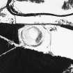
Flat roofed brick and concrete building with small extension on the W side. Measuring approximately 12m by 9m overall, the building has window opening just below the roof level. The extension on the W side has a chimney.

The building was not entered on the date of visit.

Visited by RCAHMS (DE, GS), August 1997

References

MyCanmore Image Contributions


Contribute an Image

MyCanmore Text Contributions