Barry Links, Barry Buddon Military Training Area, Rifle Ranges
Firing Range(S) (20th Century)
Site Name Barry Links, Barry Buddon Military Training Area, Rifle Ranges
Classification Firing Range(S) (20th Century)
Alternative Name(s) Spion Kop
Canmore ID 252134
Site Number NO53SW 85
NGR NO 53794 31515
NGR Description Centred on NO 53794 31515
Datum OSGB36 - NGR
Permalink http://canmore.org.uk/site/252134
- Council Angus
- Parish Barry
- Former Region Tayside
- Former District Angus
- Former County Angus
NO53SW 85 centred on 53794 31515
NO53SW 85.01 centred on 53615 31895 Rifle Range
NO53SW 85.02 centred on 53655 31415 Rifle Range
NO53SW 85.03 centred on 53830 31250 Rifle Range
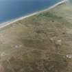
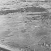
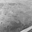
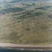
This group of three rifle ranges is located on the Spion Kop, to the N of the Buddon Ness Old High Lighthouse [NO53SW 21]. The current edition of the OS 1:10000 map (1974) shows a possible firing area but this does not match any of the three ranges visible on RCAHMS aerial photographs (RCAHMSAP 2003). These ranges probably date from the late 1970s or later.
Information from RCAHMS (GDT) 21 May 2004


