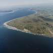
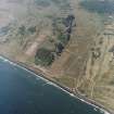
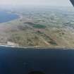
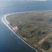
Barry Links, Barry Buddon Military Training Area
Firing Range(S) (19th Century) - (20th Century), Firing Range (First World War), Trench (First World War), Bullet (First World War), Unidentified Pottery(S) (Post Medieval)
Site Name Barry Links, Barry Buddon Military Training Area
Classification Firing Range(S) (19th Century) - (20th Century), Firing Range (First World War), Trench (First World War), Bullet (First World War), Unidentified Pottery(S) (Post Medieval)
Alternative Name(s) Barry Ridge
Canmore ID 252132
Site Number NO53SE 37
NGR NO 55455 32950
NGR Description Centred on NO 55455 32950
Datum OSGB36 - NGR
Permalink http://canmore.org.uk/site/252132
- Council Angus
- Parish Barry
- Former Region Tayside
- Former District Angus
- Former County Angus
NO53SE 37 centred 55455 32950
NO53SW 56 Centred on 55455 32950
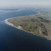
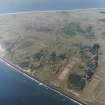
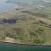
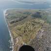
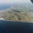
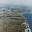
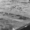
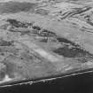
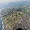
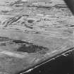
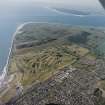
At the NE edge of the Barry Buddon Military Training Area, this site comprises two gallery ranges, aligned E to W, one on either side of Barry Ridge, a low dune extending E - W. There is a target shed set centrally between the two targets (NO 55798 32935).
The ranges are depicted on the 2nd edition of the OS 6-inch map (Forfarshire 1904, sheet LV N.E. & S.E.) with the southern range to extending 800 yards (NO 55068 32638 - NO 55783 32772) and northern range extending to 1700 yards (NO 54278 33076 - NO 55817 33073). On the northern range the distances from 1100 to 1700 yards are indicated by point positions and probably represent a single machine-gun firing position. This map shows the engine shed lying between the ranges with tramways extending to N and S, possibly carrying a moving target to both ranges.
The northern range is a standard Gallery Range with firing points at 100m intervals to 600m; the firing points at 100m, 200m and 300m have individual firing trenches, the remainder are plain grass covered. The range has 18 lanes but was previously wider (probable c30 lanes) when conforming to Imperial measurements. Traces of the 100yard-interval firing points are evident to a distance of 1000 yards.
The southern range is a 12-lane Converted Gallery (ETR) Range, with individual firing trenches at the 100m - 400m firing points. There are two target chests for each lane, mounted on top of the mantlet; the original Gallery target frames are still present There are traces evident of the old 400-600yard firing points. The range control building is to the rear of the 400m firing point, but offset to the south, allowing firing points to be used back to 600m.
Information from RCAHMS (DCC and GDT) 21 May 2004
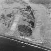
At the western end of the Converted Gallery (ETR) Range is a short distance range (probably 100 yds), oriented NNW to SSE. It was constructed between February 1953 and June 1977. This is possibly a pistol range.
Information from RCAHMS (GDT) 16 June 2004
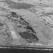
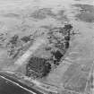
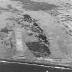
Vertical photography of 16 June 1947 (CPE/SCOT/UK211: frames 5039-5040) shows the northern gallery range with 28 targets.
Updated Information from RCAHMS (GDT) 16 June 2004
Measured Survey (February 2006)
Oxford Archaeology was commissioned in February 2006 to carry out a survey and an assessment of military trench systems at Barry Buddon Carnoustie, Angus. The trench systems were previously identified and plotted from aerial photography by Major Guy Taylor. OA was asked to check this work on the ground and to digitise the results. A detailed metric survey was carried out of the large and well preserved trench system at the east end of Barry Ridge. Other trench systems identified by Guy Taylor were examined and sketch plotted on the ground.
The survey revealed that the main area of trenches may be Great War in origin but was re-used during or immediately before the Second World War. It also demonstrated that the trenches on the western edge of the ridge were probably Second World War (or slightly earlier) in origin.
Project (March 2013 - September 2013)
A project to characterise the quantity and quality of the Scottish resource of known surviving remains of the First World War. Carried out in partnership between Historic Scotland and RCAHMS.
Excavation (20 August 2018 - 31 August 2018)
NO 54796 32758 A programme of trial trenching was carried
out, 20–31 August 2018, on land at the Barry Buddon
Training Centre. The four trenches targeted sections of a
trench network surviving as upstanding earthworks, and
investigated in 2017.
The trenches ranged in depth from 0.3m below the current
ground surface in trench one to more than 1.5m in trenches
two and four. They contained evidence of surviving trench
furniture in the form of remains of sandbags, timber and
wire revetments, and discarded barbed wire in the base
of trench three. The trenches demonstrated a range of
military trench construction techniques, including the use
of breastwork style parapets and paradoses only previously
recorded in the UK on this site in 2017.
Archive: Montrose Museum
Funder: Landmarc Support Services Ltd
Christopher Swales – Wessex Archaeology (Scotland)
(Source: DES, Volume 19)
OASIS ID: waherita1-330001


