
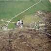
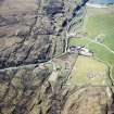
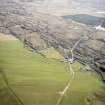
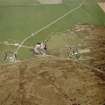
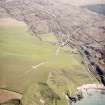
Islay, Kilchiaran, Kilchiaran Farmhouse


Farmhouse (Period Unassigned)
Site Name Islay, Kilchiaran, Kilchiaran Farmhouse
Classification Farmhouse (Period Unassigned)
Canmore ID 251235
Site Number NR26SW 36
NGR NR 20861 60366
Datum OSGB36 - NGR
Permalink http://canmore.org.uk/site/251235


- Council Argyll And Bute
- Parish Kilchoman
- Former Region Strathclyde
- Former District Argyll And Bute
- Former County Argyll
NR26SW 36.00 NR 20861 60366 Kilchiaran Farm
NR26SW 36.01 NR 20696 60311 Steading
(NB. Steading used to be recorded as NR26SW 36)

