Kirkwall, Palace Road, Earl's Palace
Palace (17th Century)
Site Name Kirkwall, Palace Road, Earl's Palace
Classification Palace (17th Century)
Alternative Name(s) Watergate
Canmore ID 2496
Site Number HY41SW 11
NGR HY 44978 10772
Datum OSGB36 - NGR
Permalink http://canmore.org.uk/site/2496

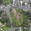


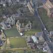
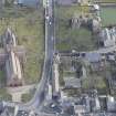
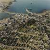
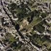
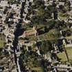
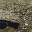
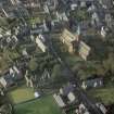








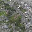
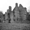
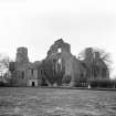

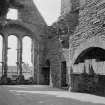
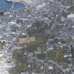
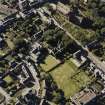
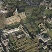





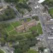
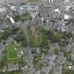
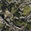






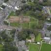
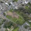








First 100 images shown. See the Collections panel (below) for a link to all digital images.
- Council Orkney Islands
- Parish Kirkwall And St Ola
- Former Region Orkney Islands Area
- Former District Orkney
- Former County Orkney
HY41SW 11 44978 10772
(HY 4495 1077) Earl's Palace (NR) (In Ruins)
OS 6" map, Orkney, 2nd ed., (1902).
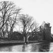
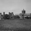
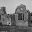
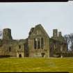
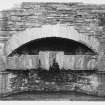
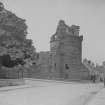
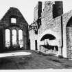
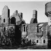
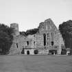
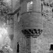
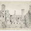
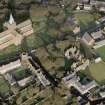
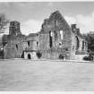
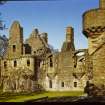
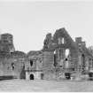
Earl Patrick's Palace stands roofless but otherwise complete. It has been described as 'the most mature and accomplished piece of Renaissance architecture left in Scotland'. Notable features are the great oriel windows, in the French manner. The palace was built by Earl Patrick Stewart between 1600 and 1607, but the full design was never completed.
W D Simpson 1961; 1965; RCAHMS 1946.
As described by W D Simpson 1965 (MoPBW pamphlet).
Visited by OS (NKB) 5 April 1964.
HY 449 108. Two short phases of archaeological fieldwork were undertaken in connection with the construction of a new sales point for the Earl's Palace. Excavation of trenches for services and foundations revealed paths that formed part of an early 19th-century garden in front of the palace ruins. This garden is recorded on a plan of 1836 by James Craig. No medieval or early post-medieval deposits were encountered.
Sponsor: Historic Scotland
M Dalland 1998.
A small scale excavation was undertaken in 1982 to determine the level of the original ground surface to the immediate east of the Palace. The ground level appears to have been at a similar level to the modern day surface. However beneath this 17th century ground level lay well preserved medieval remains. These remains were partially excavated and possibly belong to the previous Bishop's Palace, or 'Palace of Yards'. Finds included a fine Scandinavian - type comb dating from between the 12th - 14th centuries.
Unfortunately, the bulk of the field records were mislaid after the excavation.
S Winlow 2001.
Publication Account (1981)
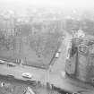
The Palace was built by Earl Patrick in the opening years of the seventeenth century and is 'not only the finest secular building in Orkney', it is 'possibly the most mature and accomplished piece of Renaissance architecture left in Scotland' (RCAM, 1946, II, 142). It stands to the south of the Cathedral and is in close proximity to the Bishop's Palace. The history of the construction of the Earl's Palace is a bitter one, for it was built with forced labour and pillaged goods provided some of the ornamentation. Shortly after it was built (though it was never fully completed), the Earl handed over the structure to Bishop Law. At that time, the Palace was known as the 'Newark of the Yards' to distinguish it from the older episcopal residence known as the 'Palace of the Yards' (RCAM, 1946, II, 142). The last ecclesiastic who is said to have resided in it was Bishop MacKenzie 1677-88 (RCAM, 1946, II, 142). The building, with its fine oriel windows, fell into disrepair after the roof was sold by the Town Council in the eighteenth century.
Information from ‘Historic Kirkwall: The Archaeological Implications of Development’ (1977).
Watching Brief (13 August 1996 - 14 August 1996)
The excavation of an inspection trench over a blocked drain (modern) on the W side of the Earl's Palace was monitored by Kirkdale Archaeology. No features were noted, other than tarmac from a recent tennis court, and the drain was located at a depth of 750mm, cut into disturbed ground.
Sponsor: Historic Scotland
G Ewart and J Thoms 1996.
Publication Account (1996)
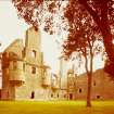
This building has been described as 'possibly the most mature and accomplished piece of Renaissance architecture left in Scotland', and it is certainly a most attractive monument set amongst trees and well-kept lawns. It was known as the New Wark of the Yards when first built, to distinguish it from the older Bishop's Palace, then known as the Place of the Yards.
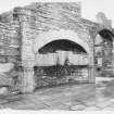
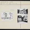
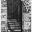
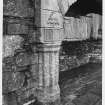
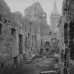
As it survives, it is an L-shaped building of two main blocks with a short wing projecting from the north-west corner of the main block, but it seems originally to have conformed to a courtyard plan, though nothing is known of the character of the west and north sides, or if indeed they were ever completed. The ground-floor consists of vaulted storerooms, a vaulted kitchen and a splendidly spacious main stairway leading to the 'state apartments' on the first floor. Traces of a second floor survive very incompletely. The outstanding features of the Palace are the main entrance, the oriel windows and the great fireplace in the hall, but there are many other interesting details. The main entrance, set at the angle of two wings, is badly weathered but still conveys a strong sense of its former grandeur; there is a Doric element in the deeply moulded half-columns flanking the door, and the capita ls were once richly decorated, as were the surrounds of the three panels above the door. The lower panel held an inscription originally, the middle panel displayed the arms of Earl Patrick, and the uppermost panel the royal arms of Scotland, both now barely discernible. Another inscribed panel was set above the corbelled chimney-breast on the adjacent wall. The door itself would have consisted of an outer wooden door and an inner iron gate or yett.
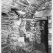
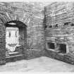
The entrance of the great hall on the first-floor is flanked on the left by a small vaulted room, used by the Earl's major-domo, and on the right by a tiny and very attractive room interpreted as an ante-chamber for guests waiting ro see the Earl. It has a stone basin in a recess just inside the entrance arch, and its barrel-vaulted ceiling has panels of fine masonry separated by moulded and decorative stone ribs.
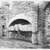
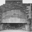
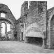
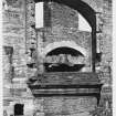
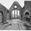
The great hall is still a magnificent though roofless chamber, and it is easy to imagine its impact when inhabited, full of people and colour and urgent conversation. It is fully 16.5m long and 6m wide, requiring two fireplaces and several fine windows, including a huge window in the south gable with triple round-headed lights. The larger firep lace on the west side of the hall was truly noble proportions: flanked by moulded jambs echoing those of the main entrance, the fireplace is framed by a straight arch some 5m long, above which there is an arch designed to lessen the strain of the weight of masonry above. The capitals of the jambs on either side are embellished with an earl's coronet and the initials P E O for Patrick, Earl of Orkney. It is recorded that several rooms of the palace were 'curiously painted with Scripture stories', like the Earl's Palace at Birsay (no. 33), and it is likely that the great hall was one of those rooms, perhaps with a painted ceiling.
Information from ‘Exploring Scotland’s Heritage: Orkney’, (1996).
Watching Brief (25 October 1999 - 29 October 1999)
A watching brief was conducted in October 1999 during the excavation of a trench for an electric cable at the Earl’s Palace, Kirkwall, Orkney (HY 449107). The trench ran across the area between the kitchen and the re-entrant angle of the Great Hall range and the earl’s bedchamber block. The very shallow foundations of the palace were observed and the possible bottoming for a paved courtyard with a stone-capped drain. A small stone cannon ball was retrieved, but from a probable 20th-century context.
Sponsor: Historic Scotland
Kirkdale Archaeology
Watching Brief (April 2003)
Kirkdale Archaeology, under the Historic Scotland minor archaeological works call-off contract, carried out a short Watching Brief at Earl's Palace, Kirkwall. More information about this event can be found in the Kirkdale Archive.
G Ewart 2003
Sponsor: Historic Scotland
Kirkdale Archaeology
Excavation (17 March 2004 - 18 March 2004)
Under the terms of its PIC call-off contract with Historic Scotland, Kirkdale Archaeology was asked to undertake a watching brief at Earl's Palace, Kirkwall, Orkney, (NGR HY 449107) on 17th March 2004. The work was required in advance of the construction of a ramp for wheelchair access into the main entrance of the Sheriff Court House. The call-out was required to ensure that the work minimised disturbance to the site, with a maximum depth of 450mm below the current ground surface, ensure that any damage to archaeological features was restricted to a defined area, and ensure a full and permanent record of any archaeology that could not be left in place.
The location of the foundation trench for the ramp was along the putative line of the E-W oriented S wall of the S range of the palace. It is not certain if the range was completed, although it is clear that it was intended to extend westwards to join the S end of the Bishop's Palace, to form a large complex round three sides of a courtyard (Pringle 1999, 35 & 38). However, a raggle for a pitched roof on the W gable of the upstanding range indicates that a building may have stood here, possibly the brewhouse (Pringle 1999, 35 & 38).
Gordon Ewart 2004
Sponsor: Historic Scotland
Kirkdale Archaeology
Watching Brief (20 February 2012 - 22 February 2012)
HY 44945 10770 A watching brief was carried out 20–22 February 2012 during work associated with the construction of a disabled access ramp. Garden soils (19th century) were recorded at a depth of 0.15m in the N end of the area. Two segments of a medieval mortared wall associated with the Earl's Palace were recorded in the centre of the area, with four courses of the E section and three of the W section surviving to at least 0.36m high. The construction cut of the wall was also seen. Stone from the wall had been removed, probably during construction of a footpath and stone steps in the late 19th or early 20th century. Features associated with the N-facing wall of the Earl's Palace Brewhouse were recorded, covered with Terram and sand and left in situ.
Archive: RCAHMS
Funder: Kirkwall Scottish Court Service
Gavin Lindsay, ORCA
2012
Earth Resistance Survey (22 June 2021)
HY 44995 10781 A geophysical survey was carried out at the Earl’s Palace, Kirkwall, on 22 June 2021. This survey formed part of a programme of research in advance of placement of a temporary portacabin.
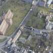
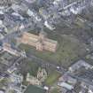
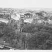
The Earl’s Palace is situated in Kirkwall town centre, just to the W of St Magnus Cathedral and to the S of the Bishop’s Palace. The Earl’s Palace was built in the early 1600s by the Earl of Orkney as an addition to the Bishops Palace, with the aim of creating a palace complex.
The survey area covers an enclosed area of approximately 50 x 20m immediately to the E of the Palace.
A resistance survey (0.5 x 0.5m intervals) has recorded a wide range of responses across the survey area. The strongest response is in the N of the area and may simply indicate a former path or track, although a more significant archaeological origin cannot be dismissed.
Along the western limits of the survey area, amorphous areas of elevated response have been noted. The complexity of the data is due to the adjacent structure, tree roots, former excavation trenches and a service trench. Within the elevated level of response more distinct anomalies have been noted which may be archaeologically significant potentially indicating structures and walls associated with the former garden
Well-defined rectilinear anomalies and trends show excellent correlation with the 1945–1970 OS mapping and likely define the limits of the former tennis courts.
Weak trends have been detected in the centre of the survey area and may be associated with the former formal garden layout, although such an interpretation is tentative given subsequent use of the area as tennis courts and the position of the trends relative to the Palace. However, it is worth noting that it is possible that these trends suggest possible deeper features that predate the current palace.
Archive: Rose Geophysical Consultants Funder: CFA Archaeology on behalf of HES
Susan Ovenden – Rose Geophysical Consultants
(Source: DES Vol 22)


