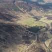
Crubenmore, Old Bridge
Road Bridge (19th Century)
Site Name Crubenmore, Old Bridge
Classification Road Bridge (19th Century)
Alternative Name(s) Glen Truin, Crubenmore Bridge; Crubenmore Bridge Over River Truim
Canmore ID 24642
Site Number NN69SE 3
NGR NN 67653 91339
Datum OSGB36 - NGR
Permalink http://canmore.org.uk/site/24642
- Council Highland
- Parish Laggan
- Former Region Highland
- Former District Badenoch And Strathspey
- Former County Inverness-shire
Substantial double span rubble bridge; pair segmental dressed rubble arch rings; splayed approaches abut arches with crude long-short masonry angle detailing. Low rubble parapets; curved approach from E bank.
Now by-passed Military road re-aligned between Dalwhinnie and Drumochter during programme military road alterations 1798-1813. River Truim forms boundary with Laggan Parish. Bridge repaired 1975 as a conservation project. (Historic Environment Scotland List Entry)
Standing Building Recording (19 February 2020 - 28 February 2020)
NN 62969 79501; NN 64588 73287; NN 63295 80662; NN 6375 8142; NN 6496 8595; NN 63094 79598; NN 6388 8278; NN 6765 9133; NN 67634 91454; NN 7645 9976; NH 7767 0193; NH 7879 0203; NH 7888 0201; NH 7899 0228; NH 7910 0267; NH 7960 0270 During February 2020 a programme of historic building recording was undertaken ahead of dualling works along the current route of the A9 between Glen Garry and Kincraig. Historic building recording was undertaken on sixteen cultural heritage assets.
A photographic survey to produce a full visual record of the current setting of Wade Bridge (Canmore ID: 24622), Crubenmore Old Bridge (Canmore ID: 24642), Crubenmore New Bridge (Canmore ID: 24643), Ruthven Barracks (Canmore ID: 25196), Lynchat Souterrain (Canmore ID: 14077), Balavil Obelisk and Burial Ground (Canmore ID: 111861), Balavil West Lodge and Gate Piers (Canmore ID: 109644), Balavil Mains and Former Steading (Canmore ID: 111860), Balavil House (Canmore ID: 12864) and Balavil East Lodge and Gate Piers (Canmore ID: 109646) was carried out. Enhanced historic building recording was carried out at Dalnaspidal Bridge (Canmore ID: 161391), Dubhaig Bridge (Canmore ID: 24606), Chuirn Bridge, Bhotie Bridge (Canmore ID: 24625) and Truim Aqueduct (Canmore ID: 205479). A ‘Basic’ historic building recording survey was carried out at Drumochter Lodge (Canmore ID: 110475).
Archive: NRHE (intended)
Funder: CH2M Fairhurst Joint Venture for Transport Scotland
Jamie Humble and Lynn Fraser − AOC Archaeology Group
(Source: DES Vol 21)


