Pricing Change
New pricing for orders of material from this site will come into place shortly. Charges for supply of digital images, digitisation on demand, prints and licensing will be altered.
Mains Of Afforsk
Rig And Furrow (Medieval) - (Post Medieval)
Site Name Mains Of Afforsk
Classification Rig And Furrow (Medieval) - (Post Medieval)
Alternative Name(s) Bennachie Forest
Canmore ID 244092
Site Number NJ62SE 136
NGR NJ 6873 2030
NGR Description NJ 6873 2030 to NJ 6927 2055
Datum OSGB36 - NGR
Permalink http://canmore.org.uk/site/244092
- Council Aberdeenshire
- Parish Oyne
- Former Region Grampian
- Former District Gordon
- Former County Aberdeenshire
NJ62SE 136 6873 2030 to 6927 2055
For enclosure (at NJ 689 2050) within the area of this rig, see NJ62SE 28.
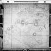
An extensive area of broad rig-and-furrow lies beneath the coniferous woodland bordering the improved fields to the NW of Mains of Afforsk farmsteading (NJ62SE 20). The rig was not visited during the RCAHMS survey of Strath Don, but it is visible on RAF vertical aerial photographs (106G/SCOT/UK 139, prints 3020-21) taken in 1946. The rig appears to be overlain by an enclosure (NJ62SE 28) depicted on an estate map of the 'Lands and Baronies of Monymusk' in 1774.
Information from RCAHMS (JRS), 20 May 2003.
NMRS, D49150/P and D49151/CN.


