
Edinburgh, Johnston Terrace To Grassmarket, Flodden Wall


Wall (Period Unassigned)
Site Name Edinburgh, Johnston Terrace To Grassmarket, Flodden Wall
Classification Wall (Period Unassigned)
Alternative Name(s) Edinburgh Town Wall
Canmore ID 240673
Site Number NT27SE 5197
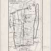
NGR NT 2527 7339
NGR Description NT 2527 7339 to NT 2528 7334
Datum OSGB36 - NGR
Permalink http://canmore.org.uk/site/240673

- Council Edinburgh, City Of
- Parish Edinburgh (Edinburgh, City Of)
- Former Region Lothian
- Former District City Of Edinburgh
- Former County Midlothian
NT27SE 5197 2527 7339 to 2528 7334
See also:
NT27SE 1571 NT 2625 7344 Drummond Street
NT27SE 1658 NT 2623 7348 Pleasance
NT27SE 3931 NT 2589 7327 Lothian Street
(Location cited as NT 2527 7339 to NT 2528 7334). Scheduled (with NT27SE 1658) as 'Edinburgh Town Wall, Flodden Wall, Johnston Terrace to Grassmarket... a stretch of the Flodden Wall, one of Edinburgh's late medieval town walls, dating to circa 1513'.
Information from Historic Scotland, scheduling documment dated 4 February 2003.
Trial Trench (21 September 2015 - 22 September 2015)
Addyman Archaeology was commissioned by Signature Pubs Ltd. to undertake an archaeological evaluation of below ground deposits prior to the development of the land to the rear of numbers 4-6 Grassmarket. It is proposed to develop this land for use as a bar/restaurant and event space.
A total of three evaluation trenches were excavated over a period of two days.
Trench 1, orientated east-west, was located in the western half of the site
perpendicular to the Flodden Wall. Trench 2, initially planned as a single trench, was excavated as two separate sections: trench 2-north, and trench 2-south. These trenches were located to the east of trench 1 near the eastern limit of the site and were orientated north-south. A full photographic record of the evaluation was produced, along with detailed measured hand drawings of the trench location plan and trench sections.
The archaeological evaluation revealed a significant depth of Late Modern
demolition deposits containing large sections of mortared masonry to be present to the rear of 4-6 Grassmarket, continuing below the maximum 1.20m depth achievable during this stage of excavation. A thin band of archaeological deposits were discovered at the northern extent of the site, between the demolition deposits and the southern wall of Dance Base; based on artefactual evidence, these deposits are though to date to the late 19th -early 20th centuries.
It was determined that the demolition deposits are likely the result of the
dismantling of the structures that formerly stood at this location and from the various stages of recent rebuild and repair of the Flodden Wall. Due to the accessibility issues of this plot of land, it seems likely the resulting rubble was heaped to the rear of the site rather than removed. It is thought that in situ archaeological deposits are likely to exist below the depth of the Late Modern rubble deposit.
Information from Andrew Morrison (Addyman Archaeology) September 2015: OASIS ID: addymana1-224096
Excavation (13 November 2017 - 8 December 2017)
Addyman Archaeology undertook a programme of archaeological work at 4-6 Grassmarket, Edinburgh, previously known as 'The Lot' in advance of its renovation and extension, in November and December 2017. The site includes the former Robertson Memorial Mission Buildings, which is a part of the larger Category B listed building 4-10 Grassmarket. The western boundary of the site is constituted by the Flodden Wall, a Scheduled Ancient Monument. The archaeological works included Historic Building Recording of the standing building, excavation in the land to the rear of the standing building, and archaeological excavation of a lift-shaft trench within the building. The excavations revealed that the rear plot had been terraced in antiquity, probably concurrently with the construction of the Robertson Memorial Mission building, and that this terracing had removed most in-situ indications of previous occupation. Substantial fragments of structural rubble, the remains of buildings pre-dating the construction of the Robertson Memorial Mission building levelled during this terracing works, were identified, as well as a series of possible buttress walls constructed above the rubble horizon. A substantial corpus of post-medieval and modern artefacts was retrieved from the deposits excavated, including some residual material of 16th to 19th century date. The lift-shaft excavations revealed drainage features related to the original construction of the standing building, and a red sandstone rubble horizon, above natural clay, predating the standing building's construction. The building recording noted previously blocked internal features including fireplaces and windows on the ground and first floors, and a 19th century underpinning to the Flodden Wall at the rear of the standing building.
Information from Philip Karsgaard (Addyman Archaeology) January 2018. OASIS ID: addymana1-304564

