Corrieyairack Pass, Melgarve, Drummin Bridge
Bridge (Period Unassigned)
Site Name Corrieyairack Pass, Melgarve, Drummin Bridge
Classification Bridge (Period Unassigned)
Alternative Name(s) Caoehan Riabhaeh Burn; Wade Road
Canmore ID 24012
Site Number NN49NE 2
NGR NN 46342 96096
Datum OSGB36 - NGR
Permalink http://canmore.org.uk/site/24012
- Council Highland
- Parish Laggan
- Former Region Highland
- Former District Badenoch And Strathspey
- Former County Inverness-shire
NN49NE 2 46348 96104
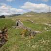
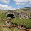
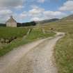
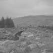
On the Wade Road of 1731 (Lin 503), which crosses the Corriyairack Pass, a low arched bridge (span 5.64m) over the Coachan Riabhack at Melgarve (Drummin) had deteriorated in recent years. The upstream half of the bridge (arch, voussoirs, spandrel and parapet) had collapsed. In 1986 this half of the arch was rebuilt in reinforced concrete and embedded stones, the original voussoirs were reinstated, the parapet was rebuilt, and the SE approach wall was taken down and rebuilt course by course. Most of the original masonwork was re-pointed. (Note: A previous concrete repair by another party was left in situ)
G R Curtis and R L Smith 1987.
NH 374 071 - NN 462 961 A watching brief was maintained over the Dalwhinnie to Fort Augustus military road or Corrieyairack Pass, focusing on the section from Fort Augustus to Melgarve which is a Scheduled Ancient Monument (NMRS NH30NE 21, NH30SE 2, NH39NE 2, NN49NW 2, NN49NE 2-4). The road was being used for the refurbishment of an electricity pylon line.
No archaeological features or deposits were revealed by groundworks. Protection was made to features that might be disturbed by work by placing of terram material.
Report lodged with Highland SMR and the NMRS.
Sponsor: Scottish Hydro-Electric plc.
S Farrell 1999


