Pricing Change
New pricing for orders of material from this site will come into place shortly. Charges for supply of digital images, digitisation on demand, prints and licensing will be altered.
Scheduled Maintenance Notice
Please be advised that this website will undergo scheduled maintenance starting on Thursday, 30th January at 11:00 AM and will last until Friday, 31st January at 10:00 AM.
During this time, the site and certain functions may be partially or fully unavailable. We apologise for any inconvenience this may cause.
Clyde Defences, Portkil Battery, Pillbox
Pillbox (First World War)
Site Name Clyde Defences, Portkil Battery, Pillbox
Classification Pillbox (First World War)
Alternative Name(s) Fort Road
Canmore ID 239749
Site Number NS28SE 39.06
NGR NS 25336 80318
Datum OSGB36 - NGR
Permalink http://canmore.org.uk/site/239749
- Council Argyll And Bute
- Parish Rosneath
- Former Region Strathclyde
- Former District Dumbarton
- Former County Dunbartonshire
Previously identified as a searchlight platform. It is a First World War pillbox.
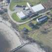
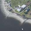
It is one of the pillboxes (called "blockhouses") marked on 1916 maps of the defences of Portkil battery (The National Archives WO 78/4396). It survives in good condition at the eastern edge of battery compound, overlooking a jetty and the foreshore.
Information from HS/RCAHMS World War One Audit Project (GJB) 5 July 2013.
NS28SE 39.03 25336 80318
A single searchlight platform situated at the SE (shore) end of the Fort Road, is visible on postwar vertical air photographs (CPE/Scot/ 350, 5209-5210, flown 17 April 1948). The platform is also depicted on the current digital edition of the OS 1:2500 map.
Information from RCAHMS (DE), March 2003
Project (March 2013 - September 2013)
A project to characterise the quantity and quality of the Scottish resource of known surviving remains of the First World War. Carried out in partnership between Historic Scotland and RCAHMS.
Field Visit (28 September 2016)
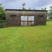
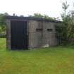
This pillbox, which now stands on the edge of a raised beach at the bottom of a private garden, originally guarding access to the Portkil Battery from the River Clyde directly to the SE and E, and from along the beach to the NE. An irregular hexagon on plan, it measures a maximum of 6.76m from NE to SW by 6.04m transversely over thick walls at least 3m high to its flat concrete roof. There is a wide opening (with modern metal doors) flanked on both sides by a narrow horizontal aperture in the rear (NW) face, and similar apertures in the other faces of the structure, including three in the S face, two each in the NNE and NE faces and one in the short ESE face. A very tall secondary doorway has been inserted into the short SW face of the building which is now used as a store for garden implements. Access to the interior could not be gained on the date of visit.
Visited by HES Survey and Recording (JRS, AM, AKK) 28 September 2016.


