
Following the launch of trove.scot in February 2025 we are now planning the retiral of some of our webservices. Canmore will be switched off on 24th June 2025. Information about the closure can be found on the HES website: Retiral of HES web services | Historic Environment Scotland
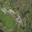
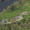
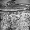
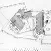
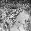
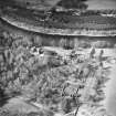
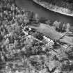
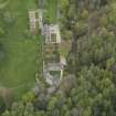
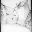
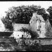
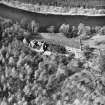
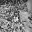
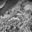
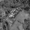
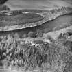
Stobhall Castle, Surrounding Walls And Sundials


Sundial(S) (Period Unassigned), Wall (Period Unassigned)
Site Name Stobhall Castle, Surrounding Walls And Sundials
Classification Sundial(S) (Period Unassigned), Wall (Period Unassigned)
Alternative Name(s) Stobhall Policies
Canmore ID 239690
Site Number NO13SW 6.03
NGR NO 13211 34351
NGR Description Centred NO 13211 34351
Datum OSGB36 - NGR
Permalink http://canmore.org.uk/site/239690


- Council Perth And Kinross
- Parish Cargill
- Former Region Tayside
- Former District Perth And Kinross
- Former County Perthshire
NO13SW 6.03 centred 13211 34351
NO13SW 6.03 centred 13211 34351
The listed sundial, a cube with a ball finial, is on the wall to the southwest overlooking the River Tay; a photograph is in MS 5741/8/34. There are also a loose stone vertical sundial on the parapet overlooking the River Tay (MS 5741/11/24), a lead vertical sundial on the wall of the courtyard (MS 5741/11/23), and an old horizontal sundial on a terrace above the river (mentioned in MS 5741/8/33 and MS 5741/11/25). (A Cassells, 1 July 2010).

