
Following the launch of trove.scot in February 2025 we are now planning the retiral of some of our webservices. Canmore will be switched off on 24th June 2025. Information about the closure can be found on the HES website: Retiral of HES web services | Historic Environment Scotland
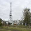
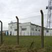
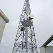
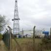
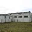
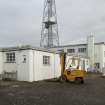
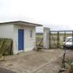
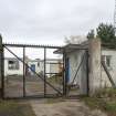
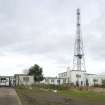
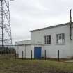
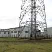
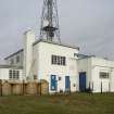
Forfar, Montreathmont Camp, Radio Station, Po Box 25


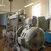
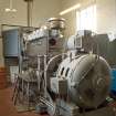
Radio Station (20th Century)
Site Name Forfar, Montreathmont Camp, Radio Station, Po Box 25
Classification Radio Station (20th Century)
Alternative Name(s) Scu3; Diplomatic Wireless Station
Canmore ID 239378
Site Number NO55SE 51.01
NGR NO 59195 54041
Datum OSGB36 - NGR
Permalink http://canmore.org.uk/site/239378


- Council Angus
- Parish Kinnell
- Former Region Tayside
- Former District Angus
- Former County Angus
NO55SE 51.01 59195 54041
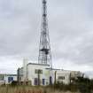
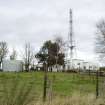
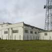
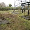
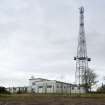
Situated about 900m due N from Montreathmont Camp is the communications block with mast(s).
The camp and radio mast complex are visible on postwar vertical air photographs (RAF CPE/Scot/UK 218, 3036-3038, flown 25 June 1947) and the complex, including at least 18 of the masts to the N are depicted on the 1:10000 scale map (1989).
Information from RCAHMS (DE), March 2003

