
Scheduled Maintenance
Please be advised that this website will undergo scheduled maintenance on the following dates: •
Tuesday 3rd December 11:00-15:00
During these times, some services may be temporarily unavailable. We apologise for any inconvenience this may cause.
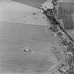
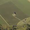
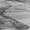
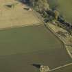
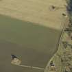
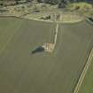
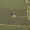
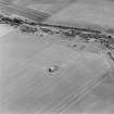
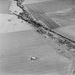
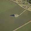
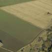
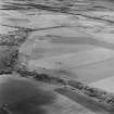
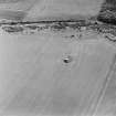
Dunino Airfield


Control Tower (20th Century)
Site Name Dunino Airfield
Classification Control Tower (20th Century)
Alternative Name(s) Hms Jackdaw Ii; Kilduncan Airfield
Canmore ID 238422
Site Number NO51SE 62.01
NGR NO 56444 11152
Datum OSGB36 - NGR
Permalink http://canmore.org.uk/site/238422


- Council Fife
- Parish St Andrews And St Leonards
- Former Region Fife
- Former District North East Fife
- Former County Fife
NO51SE 62.01 5644411152
A two-storey Naval type control tower situated near the southern perimeter of the airfield. The control tower is visible on a postwar vertical air photograph (RAF 106G/Scot/UK5, 3203, flown 14 April 1946)
Information from RCAHMS (DE), January 2004
The control tower is of a basic two-storey Naval type designed Royal Marine Engineers. The ground plan measured 38ft 3" (c.13m) x 30ft 3" (11m) which allowed two or three floors to be built above.
P Francis 1996

