|
Photographs and Off-line Digital Images |
A 57649 |
|
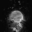
South portal, from south east |
1983 |
Item Level |
|
 |
On-line Digital Images |
SC 495476 |
Papers of Professor John R Hume, economic and industrial historian, Glasgow, Scotland |
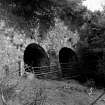
Mount Alexander Aquaduct
View along carriageway |
23/5/1976 |
Item Level |
|
 |
On-line Digital Images |
SC 495478 |
Papers of Professor John R Hume, economic and industrial historian, Glasgow, Scotland |
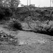
Mount Alexander Aqueduct
General View |
23/5/1976 |
Item Level |
|
 |
On-line Digital Images |
SC 495479 |
Papers of Professor John R Hume, economic and industrial historian, Glasgow, Scotland |
Mount Alexander Aquaduct
View of weir |
23/5/1976 |
Item Level |
|
|
Manuscripts |
MS 749/2303 |
Papers of Professor John R Hume, economic and industrial historian, Glasgow, Scotland |
J R Hume Industrial/CBA cards. Filed under Invernees-shire county, Kilmallie parish, Aquaduct. Photograph noted. (See NMRS MS/749 entry for Collection description) |
|
Item Level |
|
 |
On-line Digital Images |
DP 015088 |
|
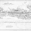
Engraving of elevation and plan inscr: ''Map of the Caledonian Canal or Inland Navigation between the Eastern and Western Sea capable of admitting a frigate of 32 guns.'' Includes longitudinal section. |
|
Item Level |
|
 |
On-line Digital Images |
SC 2386253 |
Records of the Ordnance Survey, Southampton, Hampshire, England |
Caledonian Canal, Mount Alexander Aqueduct, NN17NW 12, Ordnance Survey index card, Recto |
c. 1958 |
Item Level |
|
 |
On-line Digital Images |
SC 2564387 |
|
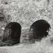
South portal, from south east |
1983 |
Item Level |
|


