|
Prints and Drawings |
RCD 31/1 |
|
Mechanical copy of drawing showing plans and dimensions of Harbours, Wharfs and Ferry-Piers.
Kirkwall Harbour, Fortrose Harbour, Cullen Harbour, Avoch Harbour, Peterhead Harbour, Portmaholmach Harbour, Channery Point-Ferry Pier, Ballintraed Harbour, Nairn Harbour, Gordoun Harbour, Burgh-head Harbour, Fraserburgh Harbour, Invergordon Ferry Piers, Dingwall Canal, Bamff Harbour, Inverfarigaig Landing-pier, St. Catherines Ferry Pier, Portree Harbour, Corran of Ardgower Pier(West side), East Tarbert Harbour, Kyle Haken S.W. Ferry Pier, Corran of Ardgower Ferry Pier (East side), Feoline Harbour, Kyle Haken N.E. Ferry Pier, Tobermory Harbour, Kyle Rhea Ferry Pier (North side), Small Isles Harbour, Kyle Rhea Fery Pier (South side), Pier for Dornie Ferry.
Titled: 'Plans And Dimensions Of Harbours, Wharfs And Ferry-Piers, Made Or Improved Under
The Direction Of The Commissioners For Highland Roads And Bridges, 1806-1821. Thos. Telford,
Engineer.' |
1806 |
Item Level |
|
|
Photographs and Off-line Digital Images |
IN 5842 |
List C Survey |
View of pier |
1975 |
Item Level |
|
 |
On-line Digital Images |
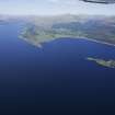
DP 076735 |
RCAHMS Aerial Photography Digital |
General oblique aerial view looking up Loch Linnhe towards Corran Ferry with Loch Leven to the right, taken from the SW. |
31/5/2009 |
Item Level |
|
 |
On-line Digital Images |
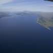
DP 077053 |
RCAHMS Aerial Photography Digital |
General oblique aerial view looking up Loch Linnhe towards Corran Ferry with Loch Leven to the right, taken from the SW. |
1/6/2009 |
Item Level |
|
 |
On-line Digital Images |
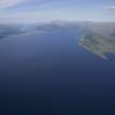
DP 077054 |
RCAHMS Aerial Photography Digital |
General oblique aerial view looking up Loch Linnhe towards Corran Ferry with Loch Leven to the right, taken from the SW. |
1/6/2009 |
Item Level |
|
 |
On-line Digital Images |
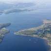
DP 108995 |
RCAHMS Aerial Photography Digital |
General oblique aerial view of Loch Linnhe, centred on the Coran Ferry, taken from the NE. |
30/4/2011 |
Item Level |
|
 |
On-line Digital Images |
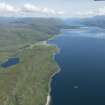
DP 193507 |
RCAHMS Aerial Photography Digital |
General oblique aerial view of Loch Linnhe with Inversanda Bay in the middle distance and Corran beyond, looking NE. |
1/7/2014 |
Item Level |
|
 |
On-line Digital Images |
DP 193508 |
RCAHMS Aerial Photography Digital |
General oblique aerial view of Loch Linnhe with Inversanda Bay in the middle distance and Corran beyond, looking NE. |
1/7/2014 |
Item Level |
|
 |
On-line Digital Images |
DP 193509 |
RCAHMS Aerial Photography Digital |
General oblique aerial view of Loch Linnhe with Inversanda Bay in the middle distance and Corran beyond, looking NE. |
1/7/2014 |
Item Level |
|
 |
On-line Digital Images |
DP 193510 |
RCAHMS Aerial Photography Digital |
General oblique aerial view of Loch Linnhe with Inversanda Bay in the middle distance and Corran beyond, looking NE. |
1/7/2014 |
Item Level |
|
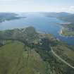 |
On-line Digital Images |
DP 193659 |
RCAHMS Aerial Photography Digital |
General oblique aerial view of Corran, looking SW. |
1/7/2014 |
Item Level |
|
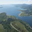 |
On-line Digital Images |
DP 193660 |
RCAHMS Aerial Photography Digital |
General oblique aerial view of Corran, looking SW. |
1/7/2014 |
Item Level |
|
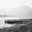 |
On-line Digital Images |
SC 1642388 |
List C Survey |
View of pier |
1975 |
Item Level |
|
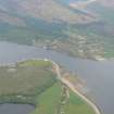 |
On-line Digital Images |
DP 342150 |
Papers of James Sloan Bone, landscape historian, Inverness, Highland, Scotland |
Aerial view of Ardgour and Corran Narrows in Loch Linhe, looking SE. |
30/5/2010 |
Item Level |
|
 |
On-line Digital Images |
SC 2385973 |
Records of the Ordnance Survey, Southampton, Hampshire, England |
Corran Ferry, Loch Linnhe, East Slipway, NN06SW 12, Ordnance Survey index card, Recto |
c. 1958 |
Item Level |
|


