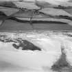
Accessibility

Font Size

100% 150% 200%

Background Colour

Default Contrast
Close Reset

Pricing Change

New pricing for orders of material from this site will come into place shortly. Charges for supply of digital images, digitisation on demand, prints and licensing will be altered. 


Montefode

Farmhouse (19th Century), Farmstead (19th Century), Mill Dam (19th Century)

Site Name Montefode

Classification Farmhouse (19th Century), Farmstead (19th Century), Mill Dam (19th Century)

Alternative Name(s) Montfode; Montefode Farmhouse And Courtyard

Canmore ID 232204

Site Number NS24SW 210

NGR NS 22662 44237

Datum OSGB36 - NGR

Permalink http://canmore.org.uk/site/232204

Ordnance Survey licence number AC0000807262. All rights reserved.
Canmore Disclaimer. © Bluesky International Limited 2025. Public Sector Viewing Terms

Toggle Aerial | View on large map

Digital Images

Administrative Areas

  • Council North Ayrshire
  • Parish Ardrossan
  • Former Region Strathclyde
  • Former District Cunninghame
  • Former County Ayrshire

Activities

Field Visit (11 February 1979 - 26 April 2010)

Site visits by Alastair Weir

References

MyCanmore Image Contributions


Contribute an Image

MyCanmore Text Contributions