
Lugate Bridge


Road Bridge (18th Century)
Site Name Lugate Bridge
Classification Road Bridge (18th Century)
Alternative Name(s) Stow; Luggate Water Bridge
Canmore ID 231765
Site Number NT44SE 37
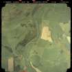
NGR NT 45006 43293
Datum OSGB36 - NGR
Permalink http://canmore.org.uk/site/231765

- Council Scottish Borders, The
- Parish Stow
- Former Region Borders
- Former District Ettrick And Lauderdale
- Former County Midlothian
NT44SE 37 45006 43293
Lugate Bridge [NAT]
OS 1:10,560 map, 1970.
Luggate [Bridge], Luggate Water, 1.5km SW of Stow [village]. Late 18th century, with three segmental arches and round cutwaters: mentioned in the New Statistical Account.
C E McWilliam 1978.
This bridge carries an unclassified public road across the Luggate Water to the SSW of Stow village (NT44SE 19).
Information from RCAHMS (RJCM), 6 February 2006.
Sbc Note (15 April 2016)
Visibility: Standing structure or monument.
Information from Scottish Borders Council

