
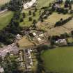
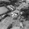
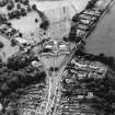
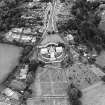
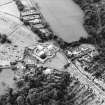
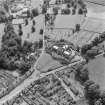
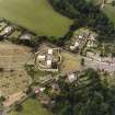
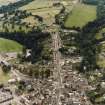
Jedburgh, Castlegate And Galahill, Castlegate Cemetery


Cemetery (19th Century)
Site Name Jedburgh, Castlegate And Galahill, Castlegate Cemetery
Classification Cemetery (19th Century)
Alternative Name(s) Castlewood Cemetery
Canmore ID 231219
Site Number NT62SW 175
NGR NT 64722 20105
Datum OSGB36 - NGR
Permalink http://canmore.org.uk/site/231219


- Council Scottish Borders, The
- Parish Jedburgh
- Former Region Borders
- Former District Roxburgh
- Former County Roxburghshire
Sbc Note (15 April 2016)
Visibility: Standing structure or monument.
Information from Scottish Borders Council

